HOW BIG
DiscoverUnderstanding scales

One question, several references

How can we compare river lengths?

Nile, Amazon, Rhône, Loire and Sorgue: distinguish course length, direct distance and source conventions.

Try it in the explorer →

Follow the course rather than drawing a straight line

A river’s length follows a course. Direct distance between a source and a mouth follows neither the meanders nor the same conventions; it answers a different question.

Choose a source and a mouth

A river system may have several branches. The selected branch, measured route and mouth boundary can change the result. That is why a length needs its convention and source.

Read the maps and their bars

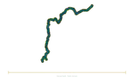
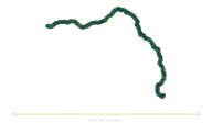
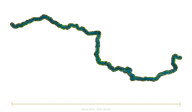
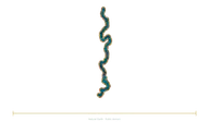
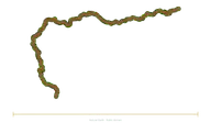
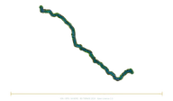
The explorer’s maps follow sourced geographic courses, simplified and sometimes partial. Only the independent bars compare documented lengths at the same scale. River widths, banks and textures are illustrative; the map’s total width does not measure the river’s length.

Avoid a misleading record

The rounded Nile and Amazon values allow reference comparisons. They are not enough to settle a universal record independently of the methods used.

This journey’s references
Sources and method

Dimensions and conventions are those of the fact sheets linked above. Illustrations remain interpretations. Providing a documentary source does not independently certify every catalogue value.

Illustration sources

IGN/OFB · BD TOPAGE 2024 (Open Licence 2.0; modified)

Source coverage: Generalised map view of the available published segments; it may be partial and include several branches. The documented length is compared using the independent bar, not the map width. No individual hydrological certification of the entire course. BD TOPAGE2024 © IGN/OFB, SANDRE; generalized department overview prepared by Deepak420-GrandMaster/France-River-Flow-Map. Modified visualization: projection, generalized source trace, interpreted water/bank texture; 2026-11-04.

Natural Earth (public domain)

Source coverage: Generalized map of the available published segments; it may be partial and include several branches. The documentary length is compared with the separate ruler, not with the width of the map. The complete course has not received individual hydrological certification. Natural Earth, public domain. Modified visualization: projection, generalized source trace, interpreted water/bank texture; 2026-11-04.

Natural Earth (public domain)

Source coverage: Generalized map of the available published segments; it may be partial and include several branches. The documentary length is compared with the separate ruler, not with the width of the map. The complete course has not received individual hydrological certification. Natural Earth, public domain. Modified visualization: projection, generalized source trace, interpreted water/bank texture; 2026-11-04.

Natural Earth (public domain)

Source coverage: Generalized map of the available published segments; it may be partial and include several branches. The documentary length is compared with the separate ruler, not with the width of the map. The complete course has not received individual hydrological certification. Natural Earth, public domain. Modified visualization: projection, generalized source trace, interpreted water/bank texture; 2026-11-04.

Natural Earth (public domain)

Source coverage: Generalized map of the available published segments; it may be partial and include several branches. The documentary length is compared with the separate ruler, not with the width of the map. The complete course has not received individual hydrological certification. Natural Earth, public domain. Modified visualization: projection, generalized source trace, interpreted water/bank texture; 2026-11-04.

Natural Earth (public domain)

Source coverage: Generalized map of the available published segments; it may be partial and include several branches. The documentary length is compared with the separate ruler, not with the width of the map. The complete course has not received individual hydrological certification. Natural Earth, public domain. Modified visualization: projection, generalized source trace, interpreted water/bank texture; 2026-11-04.