
Curiosity starts with a question
How big are
things, really?
704 references, explained comparisons and journeys to understand dimensions. Choose a question, then try it yourself.
Enter the explorer →Our place in the Universe →Answers to explore
Start with a familiar reference
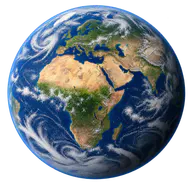
Three differences to understand
Understand what is being compared
How we learned to build things so small
From early microprocessors to complete 50-micrometre chips, then nanometre-scale details: understand what humans can manufacture without confusing packages, silicon and transistors.
UnderstandSize and distance: two ways of looking at the Universe
Distinguish a celestial body’s diameter from its distance, using the Sun, Moon and Proxima as examples.
UnderstandEarth–Moon distance: 384,400 km and light travel time
Understand the mean Earth–Moon distance through Earth diameters, a scale model and light travel time.
UnderstandSun–Earth distance: an astronomical unit in perspective
149,597,870.7 km: understand the astronomical unit, a Solar System model and about 8 minutes of light travel.
UnderstandWhat lies beyond Neptune?
Kuiper Belt, heliopause and Oort Cloud: understand the references beyond Neptune and their limits.
UnderstandHow can we compare river lengths?
Nile, Amazon, Rhône, Loire and Sorgue: distinguish course length, direct distance and source conventions.
UnderstandUnderstanding orders of magnitude and zoom
Why a small slider movement can change sizes greatly: reading a logarithmic scale.
UnderstandVoyager 1: understanding distances between stars
Voyager 1 travels about 17 kilometres each second. At that speed, how long would it take to reach Proxima? Compare Parker and light.
The catalogue
Find an object
704 fact sheets available.
Architecture
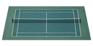 Architecture · Varies by periodTennis court23.77 m
 Architecture · Brazil · 1931Christ the Redeemer38 m
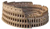 Architecture · Italy · 80Colosseum48 m
 Architecture · France · 1836Arc de Triomphe50 m
 Architecture · Varies by periodOlympic swimming pool50 m
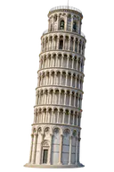 Architecture · Italy · 1372Leaning Tower of Pisa55.86 m
 Architecture · IndiaQutb Minar72.5 m
 Architecture · India · 1653Taj Mahal73 m
 Architecture · United States · 1886Statue of Liberty92.989 m
 Architecture · United Kingdom · 1859Big Ben — Elizabeth Tower96 m
 Architecture · Belgium · 1958Atomium102 m
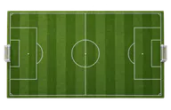 Architecture · Varies by periodFootball pitch105 m
 Architecture · IndonesiaBorobudur Temple123 m
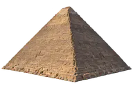 Architecture · Egypt · c. 2560 BCGreat Pyramid of Giza138.5 m
 Architecture · Australia · 1973Sydney Opera House183 m
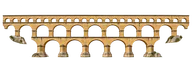 Architecture · FrancePont du Gard · upper tier275 m
 Architecture · United States · 1930Chrysler Building319 m
 Architecture · France · 1889Eiffel Tower330 m
 Architecture · United States · 1931Empire State Building443.2 m
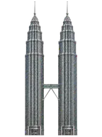 Architecture · MalaysiaPetronas Towers451.9 m
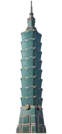 Architecture · Taiwan · 2004Taipei 101508 m
 Architecture · Canada · 1976CN Tower553.3 m
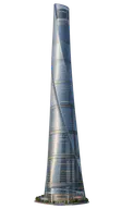 Architecture · China · 2016Shanghai Tower632 m
 Architecture · Japan · 2012Tokyo Skytree634 m
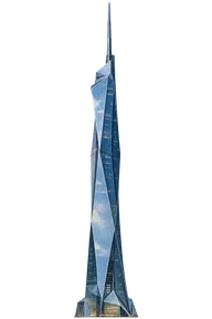 Architecture · MalaysiaMerdeka 118678.9 m
 Architecture · United Arab Emirates · 2010Burj Khalifa828 m
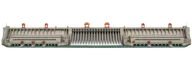 Architecture · ChinaThree Gorges Dam2.335 km
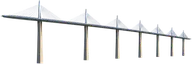 Architecture · France · 2004Millau Viaduct2.46 km
 Architecture · United States · 1937Golden Gate Bridge2.737 km
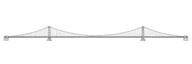 Architecture · Japan · 1998Akashi Kaikyo Bridge3.911 km
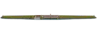 Architecture · Brazil / ParaguayItaipu Dam7.919 km
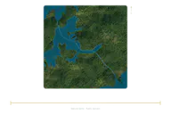 Architecture · PanamaPanama Canal80 km
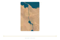 Architecture · EgyptSuez Canal193.3 km
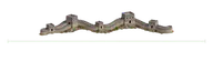 Architecture · ChinaGreat Wall of China21,000 km
Black holes

Cosmos
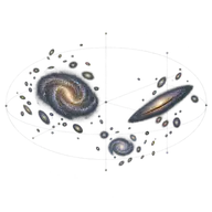 CosmosLocal Group9.9992 million light-years
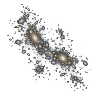 CosmosPerseus Cluster11.6 million light-yearsCosmosVirgo Cluster15.009 million light-yearsCosmosAbell 2255 radio halo16.3 million light-yearsCosmosComa Cluster20 million light-yearsCosmosPLCK G287.0+32.9 radio halo20 million light-years
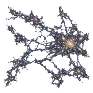 CosmosShapley Supercluster core26.093 million light-yearsCosmosVirgo Supercluster109.93 million light-years
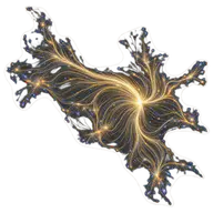 CosmosLaniakea517.93 million light-yearsCosmosCfA Great Wall600 million light-yearsCosmosSaraswati Supercluster600 million light-yearsCosmosSloan Great Wall1.37 billion light-years
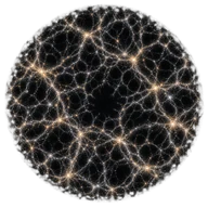 CosmosObservable universe93.016 billion light-years
Distances
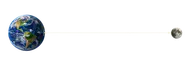 DistancesEarth–Moon distance384,400 km
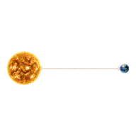 DistancesAstronomical unit149,600,000 km
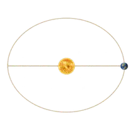 DistancesEarth’s orbit299,200,000 km
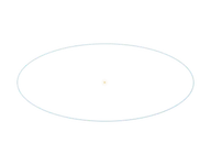 DistancesNeptune’s orbit9E9 km
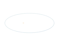 DistancesPluto’s orbit1.1818E10 km
 DistancesClassical Kuiper belt1.496E10 km
 DistancesSun–heliopause distance1.7952E10 km
 DistancesSedna’s orbit1.496E11 km
 DistancesOort cloud — inner edge5.9839E11 km
 DistancesHills cloud — inner model5.9839E12 km
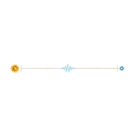 DistancesOne light-year1 light-years
 DistancesOort cloud2.0083 light-years
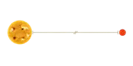 DistancesDistance to Proxima Centauri4.2465 light-years
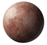
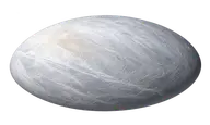
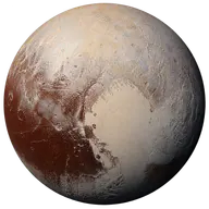
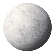
Dwarf planets
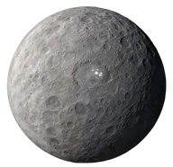
Earth
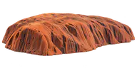 EarthUluru348 m
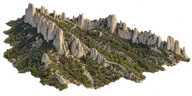 EarthDentelles de Montmirail734 m
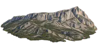 EarthSainte-Victoire mountain1.011 km
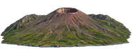 Earth · ItalyMount Vesuvius1.281 km
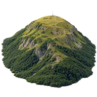 EarthPuy de Dôme1.465 km
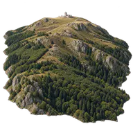 EarthMount Aigoual1.565 km
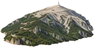 EarthMount Ventoux1.909 km
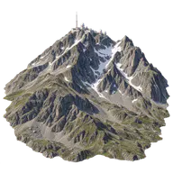 EarthPic du Midi de Bigorre2.877 km
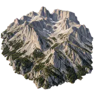 EarthMount Olympus2.918 km
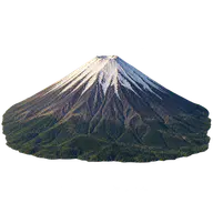 EarthMount Fuji3.776 km
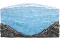 EarthAntarctic ice sheet4.757 km
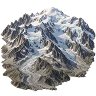 EarthMont Blanc4.806 km
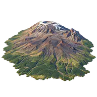 EarthKilimanjaro5.895 km
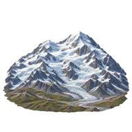 EarthDenali6.19 km
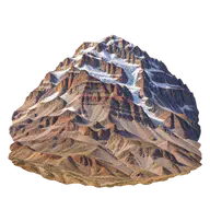 EarthAconcagua6.961 km
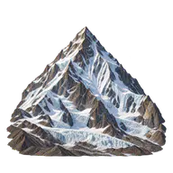 EarthK28.611 km
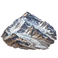 EarthMount Everest8.8489 km
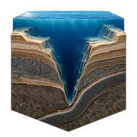 EarthMariana Trench10.9 km
 EarthKármán line · FAI altitude100 km
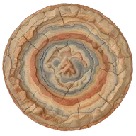 Earth · MexicoChicxulub · buried structure180 km
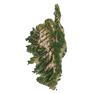 EarthCorsica183 km
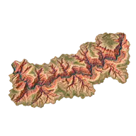 EarthGrand Canyon446 km
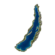 EarthLake Baikal636 km
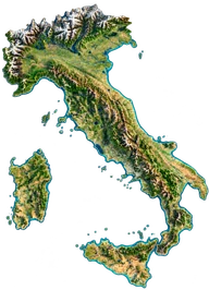 EarthItaly · Alps–Sicily1,200 km
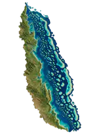 EarthGreat Barrier Reef2,300 km
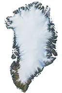 EarthGreenland2,670 km
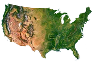 Earth · United StatesUnited States · 48 contiguous states4,800 km
Engineering
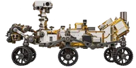 Engineering · United StatesPerseverance rover · body only3 m
 Engineering · 1959Original Mini3.054 m
 Engineering · United StatesMusic City Loop · planned tunnel inner diameter3.6576 m
 Engineering · 1938Volkswagen Beetle4.079 m
 Engineering · United StatesTesla Model 3 · RWD / Long Range4.72 m
 EngineeringShipping container · 20 feet6.058 m
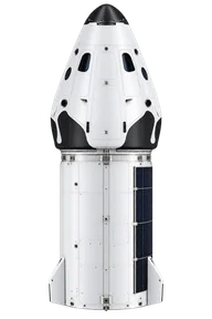 Engineering · United StatesSpaceX Dragon · capsule and trunk8.1 m
 Engineering · United StatesTesla Megapack · 4-hour configuration8.8138 m
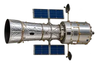 Engineering · 1990Hubble Space Telescope13.2 m
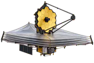 Engineering · 2021James Webb21.2 m
 Engineering · SpainSanta María · quincentenary replica26.6 m
 Engineering · 1981Space Shuttle37.24 m
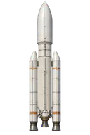 Engineering · 1996Ariane 5 rocket50.5 m
 Engineering · 1969Concorde61.66 m
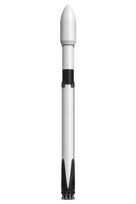 Engineering · United StatesSpaceX · Falcon 970 m
 Engineering · 2005Airbus A38073 m
 Engineering · 2010Boeing 747-876.25 m
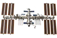 Engineering · 1998International Space Station109 m
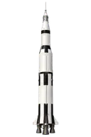 Engineering · 1967Saturn V110.6 m
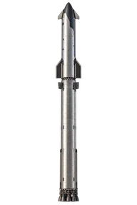 Engineering · United StatesSpaceX · Starship + Super Heavy124.4 m
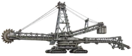 Engineering · 1995Bagger 293 · giant excavator220 m
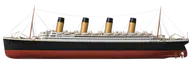 Engineering · 1912Titanic269.06 m
 Engineering · United States · 2017USS Gerald R. Ford · aircraft carrier337.11 m
 Engineering · 2004Queen Mary 2345 m
 Engineering · Finland · 2023Icon of the Seas · cruise ship365 m
 Engineering · China · 2022Ever Alot · container ship399.99 m
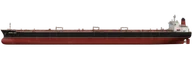 Engineering · 2010Seawise Giant · historic oil tanker458.45 m
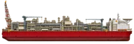 Engineering · AustraliaPrelude FLNG · floating facility488 m
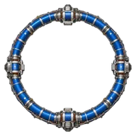 Engineering · France / SwitzerlandLHC · equivalent circle8.4858 km
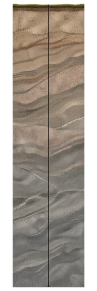 EngineeringKola SG-3 · depth reached12.262 km
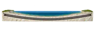 Engineering · France / United Kingdom · 1994Channel Tunnel50.45 km
Everyday objects
 Everyday objects · Varies by periodThickness of a sheet of paper100 µm
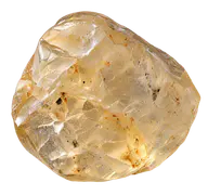 Everyday objectsGrain of sand500 µm
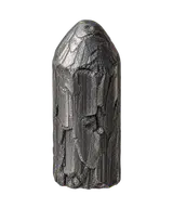 Everyday objects · Varies by periodPencil tip500 µm
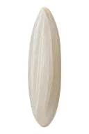 Everyday objectsGrain of rice7 mm
 Everyday objectsCoffee bean1 cm
 Everyday objects · Varies by periodDie1.6 cm
 Everyday objects · 20021-euro coin2.325 cm
 Everyday objects · 20022-euro coin2.575 cm
 Everyday objectsStrawberry3 cm
 Everyday objects · 1958 patent2 × 4 LEGO brick3.2 cm
 Everyday objects · Varies by periodTable tennis ball4 cm
 Everyday objects · Varies by periodGolf ball4.267 cm
 Everyday objectsChicken egg5.7 cm
 Everyday objects · Varies by periodTennis ball6.7 cm
 Everyday objectsOrange7.5 cm
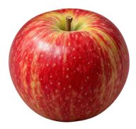 Everyday objectsApple8 cm
 Everyday objects · Contemporary modelBank card8.56 cm
 Everyday objects · Contemporary modelSmartphone15 cm
 Everyday objects · Varies by periodPencil19 cm
 Everyday objectsBanana20 cm
 Everyday objects · Varies by periodFootball (soccer ball)22 cm
 Everyday objects · Varies by periodBasketball24 cm
 Everyday objects · 1975 standardA4 sheet of paper29.7 cm
 Everyday objectsWatermelon30 cm
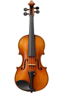 Everyday objects · Varies by periodViolin59 cm
 Everyday objects · Varies by periodTennis racket68.58 cm
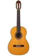 Everyday objects · Varies by periodClassical guitar1 m
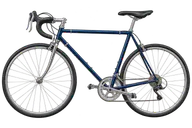 Everyday objects · Varies by periodBicycle1.8 m
 Everyday objects · Varies by periodTable tennis table2.74 m
Exoplanets
Galaxies
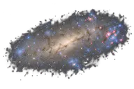 GalaxiesBarnard’s Galaxy — NGC 68227,000 light-years
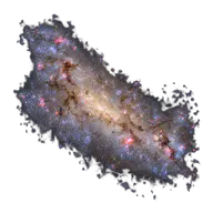 GalaxiesSmall Magellanic Cloud19,026 light-years
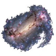 GalaxiesLarge Magellanic Cloud31,710 light-years
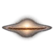 GalaxiesSombrero Galaxy50,000 light-years
 GalaxiesCentaurus A60,000 light-years
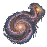 GalaxiesWhirlpool Galaxy60,000 light-years
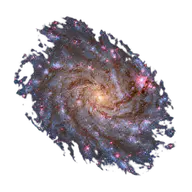 GalaxiesTriangulum Galaxy60,249 light-years
 GalaxiesBode’s Galaxy · M8190,000 light-years
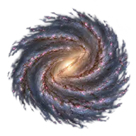 GalaxiesMilky Way100,000 light-years
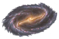 GalaxiesBarred spiral galaxy NGC 1300110,000 light-years
 GalaxiesElliptical galaxy M87120,000 light-years
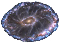 GalaxiesCartwheel Galaxy150,000 light-years
 GalaxiesPinwheel Galaxy · M101170,000 light-years
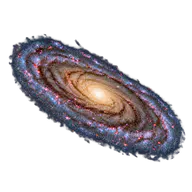 GalaxiesAndromeda Galaxy219,860 light-years
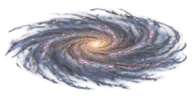 GalaxiesUGC 2885 — Rubin’s Galaxy463,000 light-years
Living things
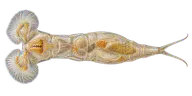 Living thingsRotifer300 µm
 Living thingsTardigrade500 µm
 Living thingsCat flea2 mm
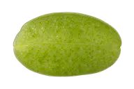 Living thingsDuckweed3 mm
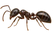 Living thingsBlack garden ant4 mm
 Living thingsSeven-spot ladybird7 mm
 Living thingsHousefly7 mm
 Living things · FranceThiomargarita magnifica · cell9.72 mm
 Living thingsHoney bee1.3 cm
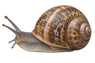 Living thingsGarden snail3 cm
 Living thingsBee hummingbird5.5 cm
 Living thingsMonarch butterfly10 cm
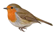 Living thingsEuropean robin14 cm
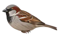 Living thingsHouse sparrow16 cm
 Living thingsRed squirrel22 cm
 Living thingsEuropean hedgehog25 cm
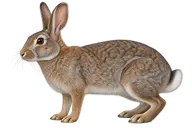 Living thingsEuropean rabbit40 cm
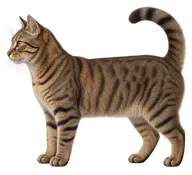 Living thingsDomestic cat46 cm
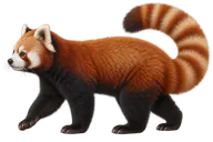 Living thingsRed panda60 cm
 Living thingsEuropean badger70 cm
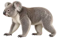 Living thingsKoala70 cm
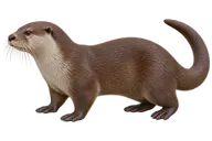 Living thingsEurasian otter70 cm
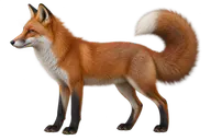 Living thingsRed fox70 cm
 Living thingsEurasian beaver90 cm
 Living thingsEmperor penguin1.15 m
 Living thingsGreater flamingo1.3 m
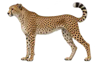 Living thingsCheetah1.3 m
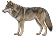 Living thingsGray wolf1.3 m
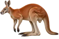 Living thingsRed kangaroo1.5 m
 Living thingsGiant panda1.5 m
 Living thingsWestern gorilla1.7 m
 Living thingsAdult human1.7 m
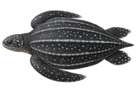 Living thingsLeatherback sea turtle1.7 m
 Living thingsLion1.9 m
 Living thingsNuclear DNA of one cell · unfolded2 m
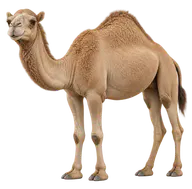 Living thingsDromedary2 m
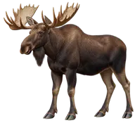 Living thingsMoose2 m
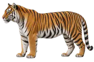 Living thingsTiger2 m
 Living thingsSunflower2 m
 Living thingsGolden eagle2.1 m
 Living thingsPlains zebra2.3 m
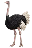 Living thingsOstrich2.5 m
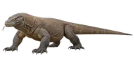 Living thingsKomodo dragon2.5 m
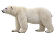 Living thingsPolar bear2.5 m
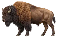 Living thingsAmerican bison3 m
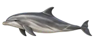 Living thingsCommon bottlenose dolphin3 m
 Living thingsWandering albatross3.1 m
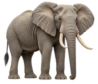 Living thingsAfrican bush elephant3.2 m
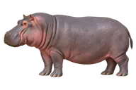 Living thingsHippopotamus3.5 m
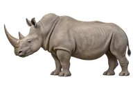 Living thingsWhite rhinoceros3.7 m
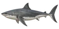 Living thingsGreat white shark4.5 m
 Living thingsSaltwater crocodile5 m
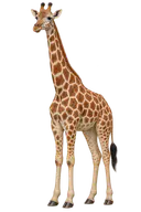 Living thingsGiraffe5 m
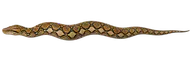 Living thingsReticulated python5 m
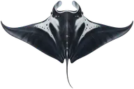 Living thingsGiant oceanic manta ray6 m
 Living thingsOrca7 m
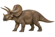 Living thingsTriceratops8 m
 Living thingsGiant squid12 m
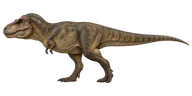 Living thingsTyrannosaurus12.3 m
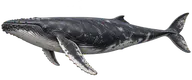 Living thingsHumpback whale15 m
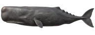 Living thingsSperm whale16 m
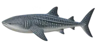 Living thingsWhale shark · exceptional specimen18.8 m
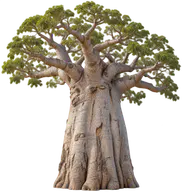 Living thingsAfrican baobab20 m
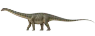 Living thingsDiplodocus25 m
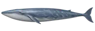 Living thingsBlue whale27 m
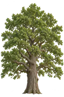 Living thingsEnglish oak30 m
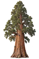 Living thingsGeneral Sherman giant sequoia83.8 m
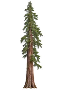 Living thingsHyperion · coast redwood (2019)116.07 m
Microcosm
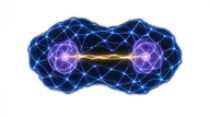 MicrocosmPlanck length1.62 × 10⁻³⁵ m
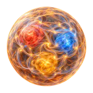 MicrocosmProton1.68 fm
 MicrocosmClassical electron radius2.8179 fm
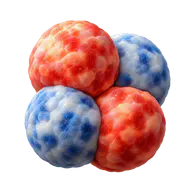 MicrocosmHelium nucleus3.4 fm
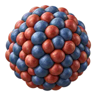 MicrocosmUranium nucleus15 fm
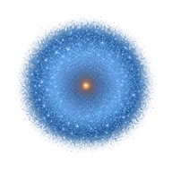 MicrocosmHydrogen atom106 pm
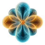 MicrocosmCarbon atom140 pm
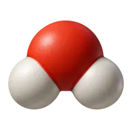 MicrocosmWater molecule275 pm
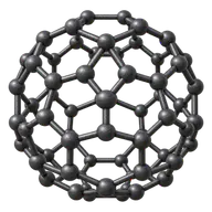 MicrocosmFullerene C60710 pm
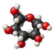 MicrocosmGlucose molecule900 pm
 MicrocosmDNA2 nm
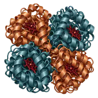 MicrocosmHaemoglobin5.5 nm
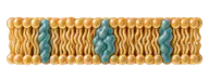 MicrocosmCell membrane7.5 nm
 MicrocosmIgG antibody14 nm
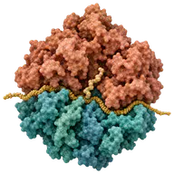 MicrocosmRibosome25 nm
 MicrocosmPoliovirus30 nm
 MicrocosmInfluenza virus100 nm
 MicrocosmCoronavirus120 nm
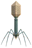 MicrocosmBacteriophage T4200 nm
 MicrocosmMimivirus · including fibres750 nm
 MicrocosmEscherichia coli2 µm
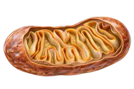 MicrocosmMitochondrion2 µm
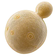 MicrocosmBaker’s yeast5 µm
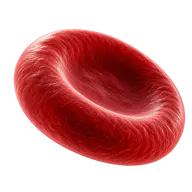 MicrocosmRed blood cell7.5 µm
 MicrocosmNeutrophil12 µm
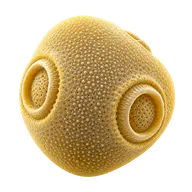 MicrocosmBirch pollen grain25 µm
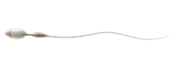 MicrocosmHuman sperm cell55 µm
 MicrocosmHuman hair70 µm
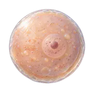 MicrocosmHuman oocyte120 µm
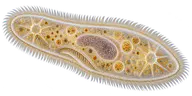 MicrocosmParamecium200 µm
Microelectronics
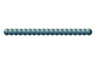 Microelectronics · 2022Record transistor · 0.34 nm gate340 pm
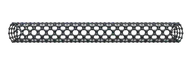 Microelectronics · 2016Experimental transistor · 1 nm nanotube gate1 nm
 Microelectronics · PDK 2020SKY130 polysilicon line150 nm
 Microelectronics · Varies by periodGold bond wire25 µm
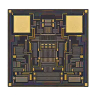 Microelectronics · 2007Hitachi · 50 µm RFID chip50 µm
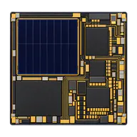 Microelectronics · 2018Michigan · 0.3 mm microdevice300 µm
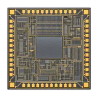 Microelectronics · Early 2000sHitachi µ-chip · 0.4 mm400 µm
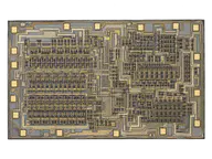 Microelectronics · 1971Intel 4004 · bare die4 mm
 Microelectronics2N3904 · TO-92 transistor5.33 mm
 Microelectronics2N2222A · TO-18 metal-can transistor5.84 mm
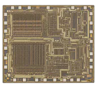 Microelectronics · 1978Intel 8086 · bare die6 mm
 MicroelectronicsIRFZ44N · TO-220 power MOSFET1.054 cm
 Microelectronics · 1971Intel 4004 · DIP package2 cm
 Microelectronics · 2023Core i9-14900K · package4.5 cm
Microscopic manufacturing
Moons
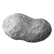 MoonsStyx10.4 km
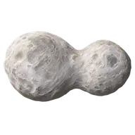 MoonsKerberos12 km
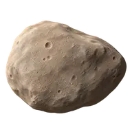 MoonsDeimos12.4 km
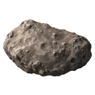 MoonsAdrastea16.4 km
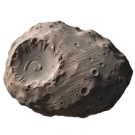 MoonsPhobos22.16 km
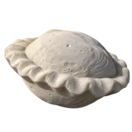 MoonsPan28 km
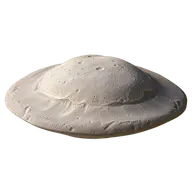 MoonsAtlas30.2 km
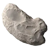 MoonsHelene36 km
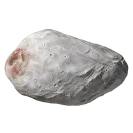 MoonsNix36 km
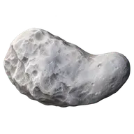 MoonsHydra37 km
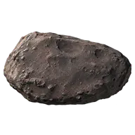 MoonsMetis43 km
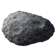 MoonsNaiad58 km
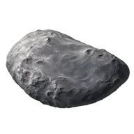 MoonsThalassa80 km
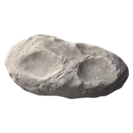 MoonsPandora81.2 km
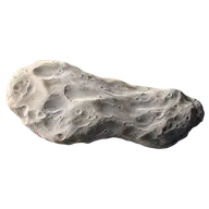 MoonsPrometheus86.2 km
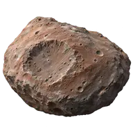 MoonsThebe98.6 km
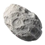 MoonsEpimetheus116.4 km
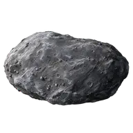 MoonsDespina148 km
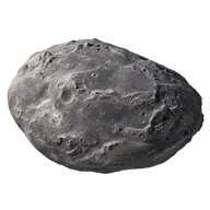 MoonsGalatea158 km
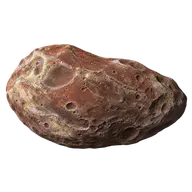 MoonsAmalthea167 km
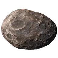 MoonsHimalia170 km
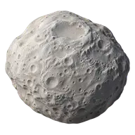 MoonsJanus178.4 km
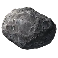 MoonsLarissa192 km
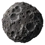 MoonsPhoebe213 km
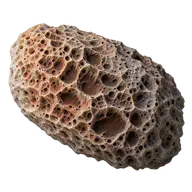 MoonsHyperion270 km
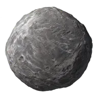 MoonsNereid340 km
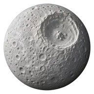 MoonsMimas396.4 km
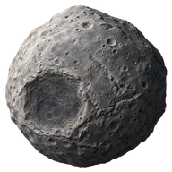 MoonsProteus416 km
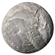 MoonsMiranda471.6 km
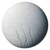 MoonsEnceladus504.2 km
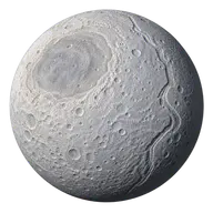 MoonsTethys1,062.2 km
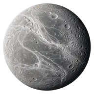 MoonsDione1,122.8 km
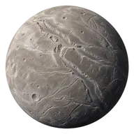 MoonsAriel1,157.8 km
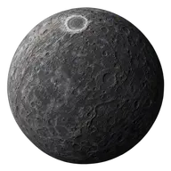 MoonsUmbriel1,169.4 km
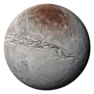 MoonsCharon1,212 km
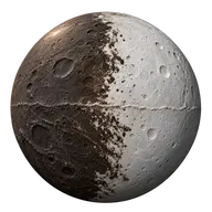 MoonsIapetus1,468.6 km
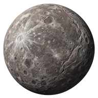 MoonsOberon1,522.8 km
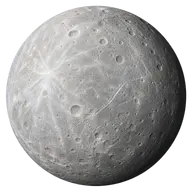 MoonsRhea1,527 km
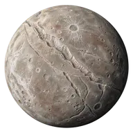 MoonsTitania1,577.8 km
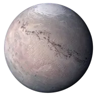 MoonsTriton2,705.2 km
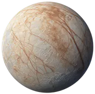 MoonsEuropa3,121.6 km
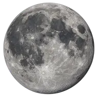 MoonsMoon3,474.8 km
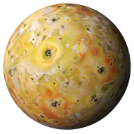 MoonsIo3,643 km
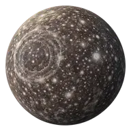 MoonsCallisto4,820.6 km
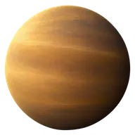 MoonsTitan5,149.5 km
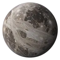 MoonsGanymede5,262.4 km
Nanofabrication
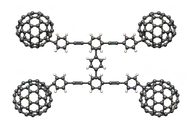 Nanofabrication · United States · 2005Rice molecular nanocar4 nm
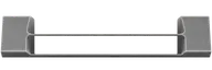 Nanofabrication · United States · 1997Suspended silicon wire · width30 nm
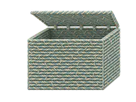 Nanofabrication · Denmark · 2009DNA box with a lid42 nm
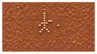 Nanofabrication · United States · 2013IBM atomic movie frame45 nm
 Nanofabrication · United States · 1997Nanoguitar string · width50 nm
 Nanofabrication · United States · 2006DNA origami face100 nm
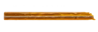 Nanofabrication · United States · 2019Neuralink · experimental thread thickness (2019)5 µm
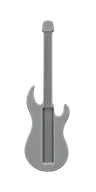 Nanofabrication · United States · 1997Silicon nanoguitar10 µm
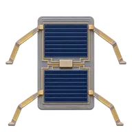 Nanofabrication · United States · 2020Cornell walking microrobot70 µm
Nebulae
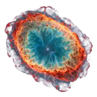 NebulaeRing Nebula1 light-years
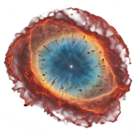 NebulaeHelix Nebula2.5368 light-years
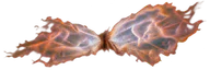 NebulaeButterfly Nebula · NGC 63023 light-years
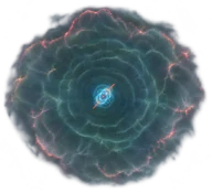 NebulaeCat’s Eye Nebula · shells5 light-years
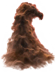 NebulaeHorsehead Nebula5 light-years
 NebulaeCrab Nebula10.993 light-years
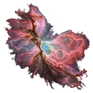 NebulaeOrion Nebula23.994 light-years
 NebulaeLagoon Nebula55 light-years
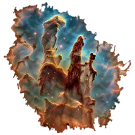 NebulaeEagle Nebula69.762 light-years
 NebulaeRosette Nebula100 light-years
 NebulaeCarina Nebula300 light-years
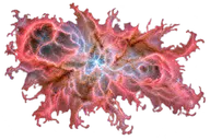 NebulaeTarantula Nebula600 light-years
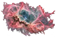 NebulaeNGC 6041,500 light-years
Planetary landforms
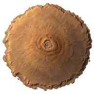
Planets
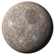
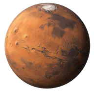
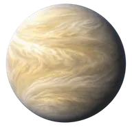
Rivers
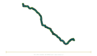 RiversSorgue (Vaucluse)30.4 km
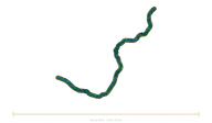 RiversDurance323 km
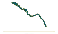 RiversSeine777 km
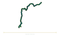 RiversRhône812 km
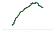 RiversChenab974 km
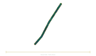 RiversKoksoak1,000 km
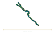 RiversUsumacinta1,000 km
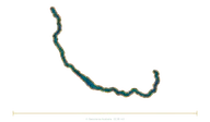 RiversFlinders1,004 km
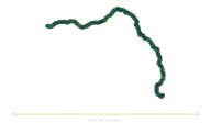 RiversLoire1,006 km
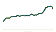 RiversTagus1,006 km
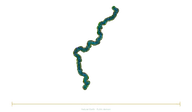 RiversKhopyor1,010 km
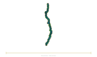 RiversEssequibo1,014 km
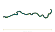 RiversGila1,015 km
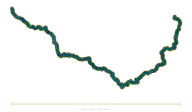 RiversDaugava1,020 km
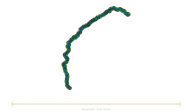 RiversChambal1,024 km
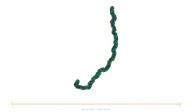 RiversPur1,024 km
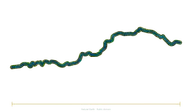 RiversAruwimi1,030 km
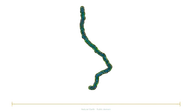 RiversLogone1,033 km
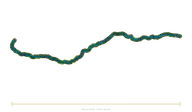 RiversApure1,038 km
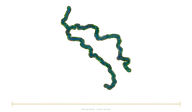 RiversOder–Warta1,045 km
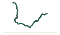 RiversTennessee1,049 km
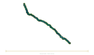 RiversBermejo1,050 km
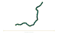 RiversKunene1,050 km
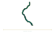 RiversFly1,050 km
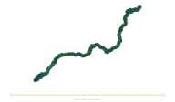 RiversKuskokwim1,050 km
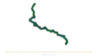 RiversSeversky Donets1,053 km
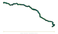 RiversChu1,067 km
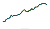 RiversSanaga–Djerem1,067 km
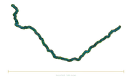 RiversAras1,072 km
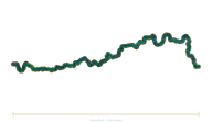 RiversHuai1,078 km
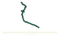 RiversGhaghara1,080 km
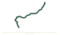 RiversYellowstone1,080 km
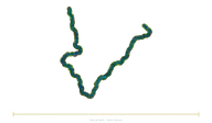 RiversMaya1,087 km
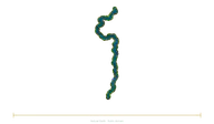 RiversBarito1,090 km
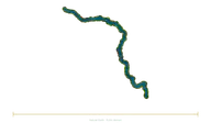 RiversTyung1,092 km
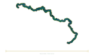 RiversGambia1,094 km
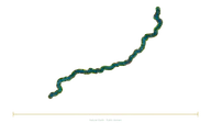 RiversBani1,100 km
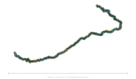 RiversDraa1,100 km
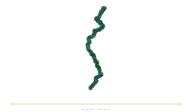 RiversHuallaga1,100 km
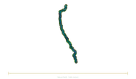 RiversKwango1,100 km
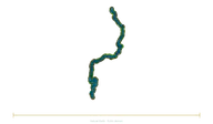 RiversOmo1,104 km
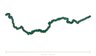 RiversCumberland1,105 km
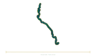 RiversMamberamo1,112 km
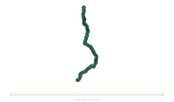 RiversOmolon1,114 km
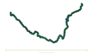 RiversLiard1,115 km
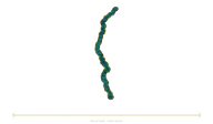 RiversJialing1,119 km
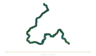 RiversAnadyr1,120 km
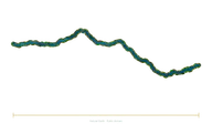 RiversCimarron1,123 km
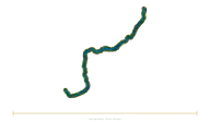 RiversOrkhon1,124 km
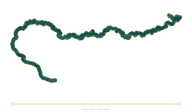 RiversSepik1,126 km
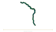 RiversSobat–Pibor1,126 km
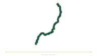 RiversDesna1,130 km
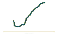 RiversHelmand1,130 km
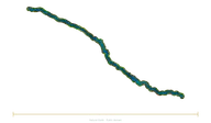 RiversTietê1,130 km
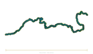 RiversVychegda1,130 km
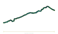 RiversYobe–Hadejia1,135 km
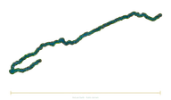 RiversParaíba do Sul1,137 km
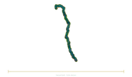 RiversJames (Dakotas)1,143 km
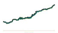 RiversKapuas1,143 km
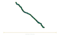 RiversRed River1,149 km
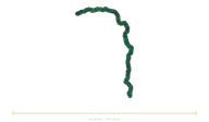 RiversSankuru1,150 km
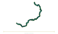 RiversWu1,150 km
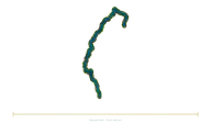 RiversChindwin1,158 km
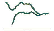 RiversMun–Chi1,162 km
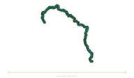 RiversWhite (Arkansas)1,162 km
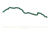 RiversMilk1,173 km
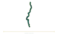 RiversAripuanã1,175 km
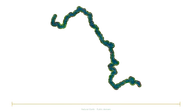 RiversMarkha1,181 km
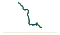 RiversMin–Dadu1,182 km
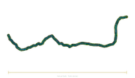 RiversLukuga1,184 km
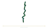 RiversMobile1,192 km
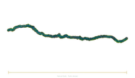 RiversFimi–Lukenie1,194 km
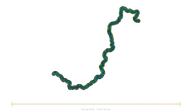 RiversAwash1,200 km
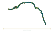 RiversOgooué1,200 km
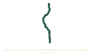 RiversShire1,200 km
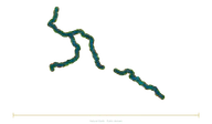 RiversVistula–Narew1,213 km
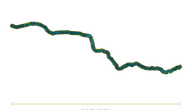 RiversKansas–Republican1,218 km
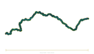 RiversNorth Saskatchewan1,220 km
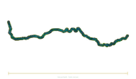 RiversCanadian1,223 km
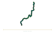 RiversAthabasca1,231 km
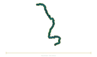 RiversRhine1,233 km
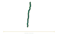 RiversJuruena1,240 km
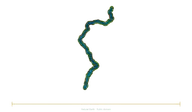 RiversZeya1,242 km
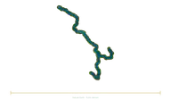 RiversElbe–Vltava1,252 km
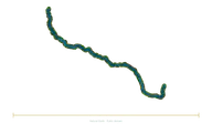 RiversGuaporé1,260 km
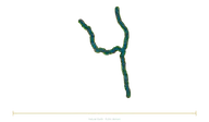 RiversRed River (Canada)–Assiniboine1,260 km
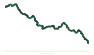 RiversRio Grande de Santiago–Lerma1,270 km
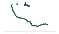 RiversOttawa1,271 km
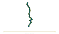 RiversLomami1,280 km
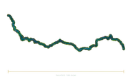 RiversKrishna1,290 km
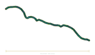 RiversRuki1,296 km
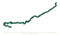 RiversInírida1,300 km
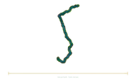 RiversIriri1,300 km
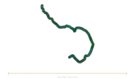 RiversNeva–Vuoksi1,300 km
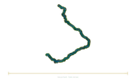 RiversNorthern Dvina–Sukhona1,302 km
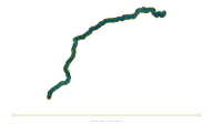 RiversJavari1,309 km
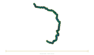 RiversTaseyeva–Chuna1,319 km
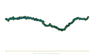 RiversIguazu1,320 km
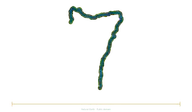 RiversBranco–Uraricoera1,326 km
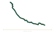 RiversHai1,329 km
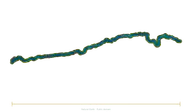 RiversNarmada1,333 km
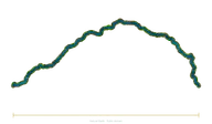 RiversLachlan1,339 km
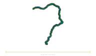 RiversLiao–Xiliao1,345 km
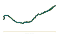 RiversMadre de Dios1,347 km
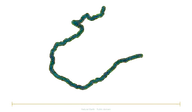 RiversKızılırmak1,355 km
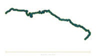 RiversRio Grande (Brazil)1,360 km
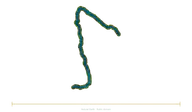 RiversFraser1,368 km
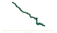 RiversApaporis1,370 km
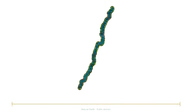 RiversNen1,370 km
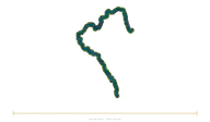 RiversVyatka1,370 km
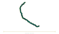 RiversYamuna1,376 km
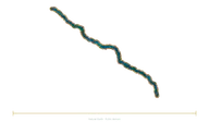 RiversColorado (Texas)1,387 km
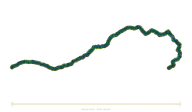 RiversBenue1,400 km
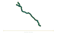 RiversChari1,400 km
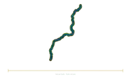 RiversParnaíba1,400 km
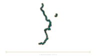 RiversWarburton–Georgina1,400 km
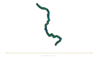 RiversTaz1,401 km
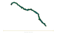 RiversDniester1,411 km
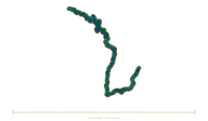 RiversBelaya1,420 km
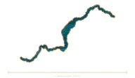 RiversCooper–Barcoo1,420 km
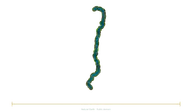 RiversUpper Tocantins1,427 km
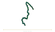 RiversUpper Columbia1,430 km
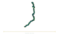 RiversOlyokma1,436 km
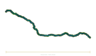 RiversIli1,439 km
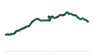 RiversSutlej1,450 km
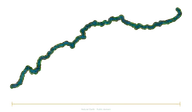 RiversVaal1,458 km
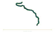 RiversSangha–Ngoko1,459 km
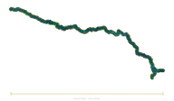 RiversGodavari1,465 km
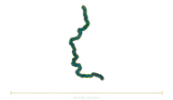 RiversUpper Yenisei–Little Yenisei1,480 km
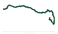 RiversMurrumbidgee1,485 km
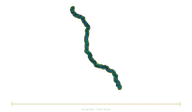 RiversPecos1,490 km
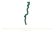 RiversYana–Sartang1,492 km
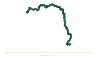 RiversUpper Murray1,500 km
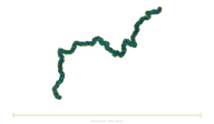 RiversOka1,500 km
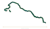 RiversKura1,515 km
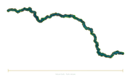 RiversHan1,532 km
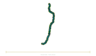 RiversMagdalena1,550 km
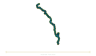 RiversYalong1,571 km
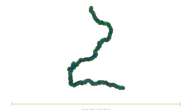 RiversKafue1,576 km
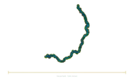 RiversAlazeya1,590 km
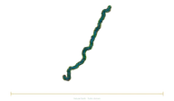 RiversTobol1,591 km
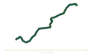 RiversShilka–Onon1,592 km
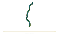 RiversBeni1,599 km
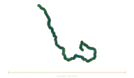 RiversBlue Nile1,600 km
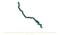 RiversOkavango1,600 km
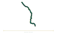 RiversVolta1,600 km
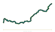 RiversChurchill1,609 km
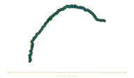 RiversUruguay1,610 km
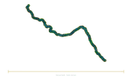 RiversUpper Jubba–Ganale Dorya1,634 km
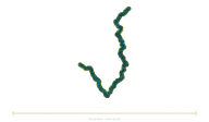 RiversKhatanga–Kotuy1,636 km
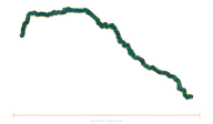 RiversSenegal1,641 km
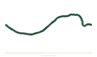 RiversPlatte1,690 km
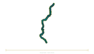 RiversIndigirka1,726 km
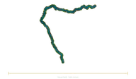 RiversMarañón1,737 km
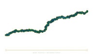 RiversGuaviare1,760 km
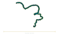 RiversChulym1,799 km
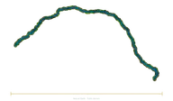 RiversLimpopo1,800 km
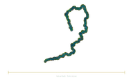 RiversKama1,805 km
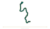 RiversPechora1,809 km
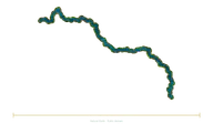 RiversStony Tunguska1,865 km
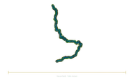 RiversDon1,870 km
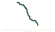 RiversTigris (river)1,950 km
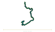 RiversVitim1,978 km
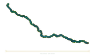 RiversIçá2,005 km
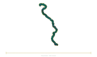 RiversUpper Mississippi2,010 km
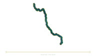 RiversNorthern Salado2,010 km
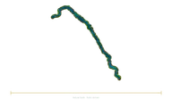 RiversBrazos–Double Mountain Fork2,060 km
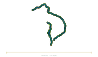 RiversJubba–Shebelle2,064 km
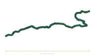 RiversTarim2,100 km
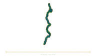 RiversXingu2,100 km
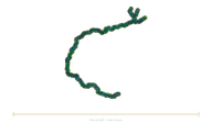 RiversOrinoco2,101 km
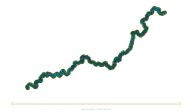 RiversOhio–Allegheny2,102 km
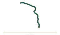 RiversKasai2,153 km
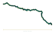 RiversRed River (United States)2,188 km
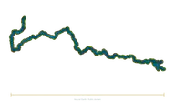 RiversPearl–Xi2,200 km
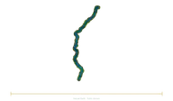 RiversTapajós–Teles Pires2,210 km
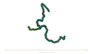 RiversColumbia–Snake2,250 km
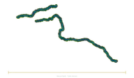 RiversNegro2,250 km
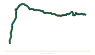 RiversUbangi–Uele2,270 km
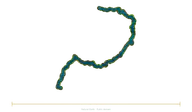 RiversAldan2,273 km
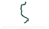 RiversDnieper2,287 km
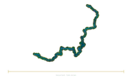 RiversOlenyok2,292 km
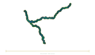 RiversSonghua2,309 km
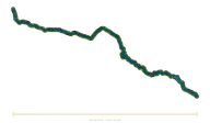 RiversArkansas2,348 km
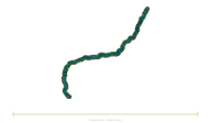 RiversJuruá2,410 km
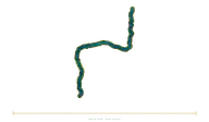 RiversUral2,428 km
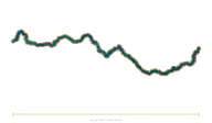 RiversOrange River2,432 km
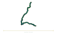 RiversIshim2,450 km
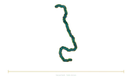 RiversUpper Ob–Katun2,490 km
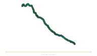 RiversPilcomayo2,500 km
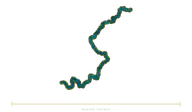 RiversKolyma2,513 km
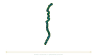 RiversParaguay2,549 km
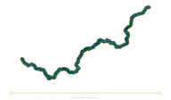 RiversNelson–Saskatchewan2,570 km
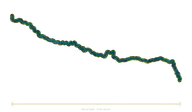 RiversJapurá2,615 km
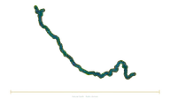 RiversAmu Darya–Panj2,620 km
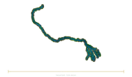 RiversPadma–Ganges2,704 km
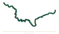 RiversVilyuy2,720 km
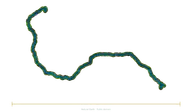 RiversZambezi2,740 km
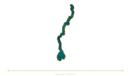 RiversIrrawaddy–N'Mai2,809 km
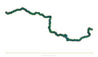 RiversDanube2,850 km
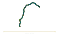 RiversSão Francisco2,914 km
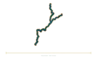 RiversColorado–Green2,945 km
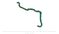 RiversLower Tunguska2,989 km
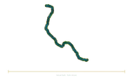 RiversRio Grande3,057 km
 RiversSt. Lawrence–Niagara3,058 km
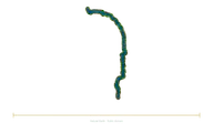 RiversSalween3,060 km
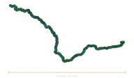 RiversSyr Darya–Naryn3,078 km
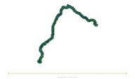 RiversIndus–Sênggê Zangbo3,180 km
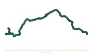 RiversYukon3,185 km
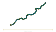 RiversPurus3,211 km
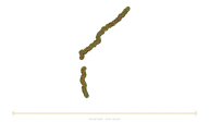 RiversMadeira–Mamoré3,380 km
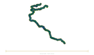 RiversShatt al-Arab–Euphrates3,596 km
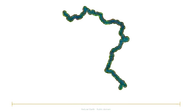 RiversVolga3,645 km
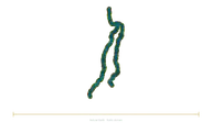 RiversTocantins–Araguaia3,650 km
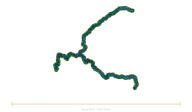 RiversMurray–Darling3,672 km
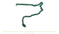 RiversBrahmaputra–Yarlung Tsangpo3,969 km
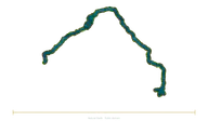 RiversNiger4,200 km
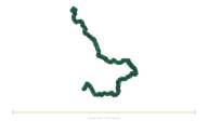 RiversMackenzie–Slave4,241 km
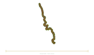 RiversMekong4,350 km
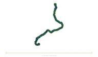 RiversLena4,400 km
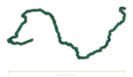 RiversAmur–Argun4,444 km
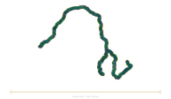 RiversCongo–Lualaba4,700 km
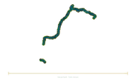 RiversRío de la Plata–Paraná4,880 km
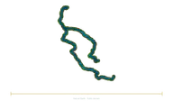 RiversOb–Irtysh5,410 km
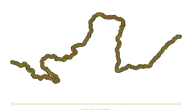 RiversYellow River5,464 km
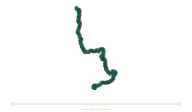 RiversYenisei–Angara5,539 km
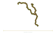 RiversMississippi–Missouri6,275 km
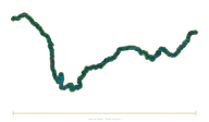 RiversYangtze–Jinsha6,300 km
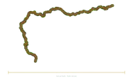 RiversAmazon6,400 km
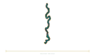 RiversNile6,650 km
Small bodies
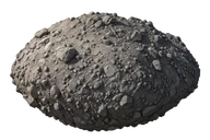 Small bodiesDimorphos · equivalent diameter (2023)151 m
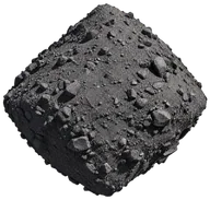 Small bodiesBennu · radar mean diameter492 m
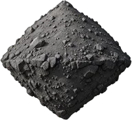 Small bodiesRyugu · reference diameter900 m
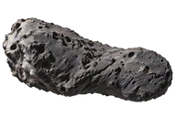 Small bodiesHalley · nucleus only15 km
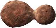 Small bodiesArrokoth · long axis35 km
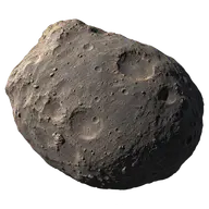 Small bodies59 Elpis165.12 km
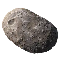 Small bodies2060 Chiron166 km
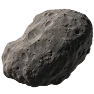 Small bodies49 Pales166.25 km
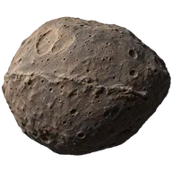 Small bodies566 Stereoskopia167.38 km
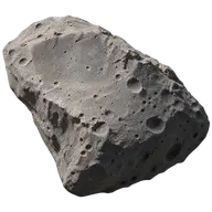 Small bodies22 Kalliope167.54 km
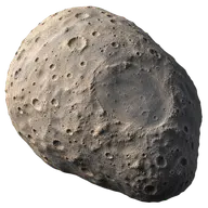 Small bodies532 Herculina167.79 km
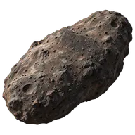 Small bodies488 Kreusa168.12 km
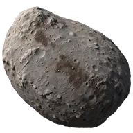 Small bodies47 Aglaja168.17 km
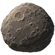 Small bodies241 Germania168.9 km
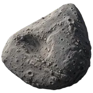 Small bodies790 Pretoria170.37 km
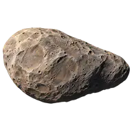 Small bodies153 Hilda170.63 km
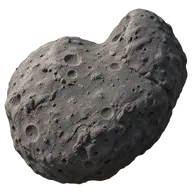 Small bodies409 Aspasia171.01 km
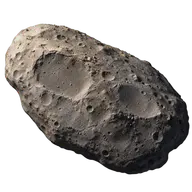 Small bodies747 Winchester171.71 km
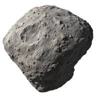 Small bodies372 Palma173.64 km
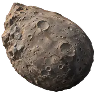 Small bodies259 Aletheia174.32 km
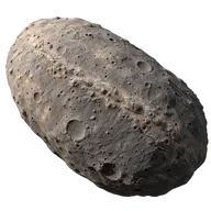 Small bodies423 Diotima175.86 km
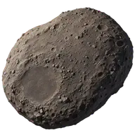 Small bodies96 Aegle177.77 km
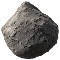 Small bodies209 Dido179.01 km
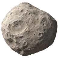 Small bodies39 Laetitia179.48 km
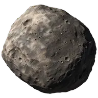 Small bodies165 Loreley180.08 km
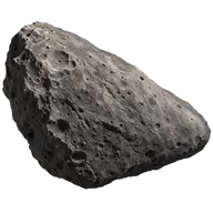 Small bodies130 Elektra180.65 km
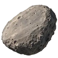 Small bodies6 Hebe185.18 km
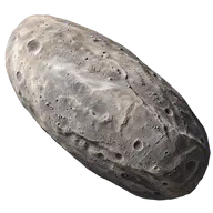 Small bodies54598 Bienor187.5 km
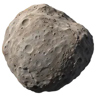 Small bodies29 Amphitrite189.56 km
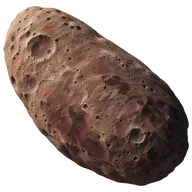 Small bodies5145 Pholus190 km
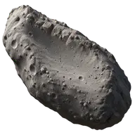 Small bodies9 Metis190 km
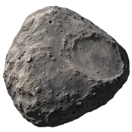 Small bodies702 Alauda190.98 km
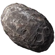 Small bodies42355 Typhon192 km
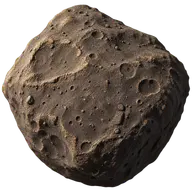 Small bodies154 Bertha192.61 km
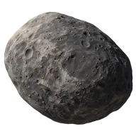 Small bodies24 Themis198 km
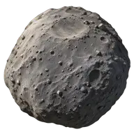 Small bodies334 Chicago198.77 km
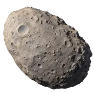 Small bodies7 Iris199.83 km
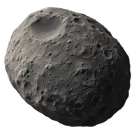 Small bodies19 Fortuna200 km
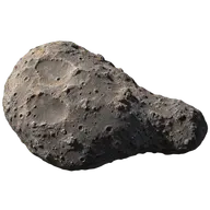 Small bodies45 Eugenia202.33 km
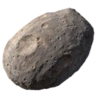 Small bodies13 Egeria202.64 km
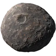 Small bodies94 Aurora204.89 km
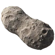 Small bodies41 Daphne205.5 km
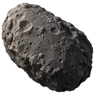 Small bodies106 Dione207.87 km
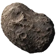 Small bodies117 Lomia208.97 km
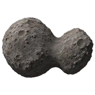 Small bodies121 Hermione209 km
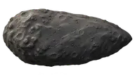 Small bodies107 Camilla210.37 km
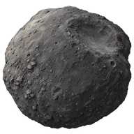 Small bodies375 Ursula216 km
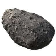 Small bodies48 Doris216.47 km
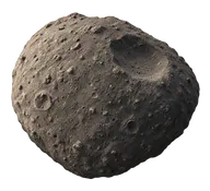 Small bodies324 Bamberga220.69 km
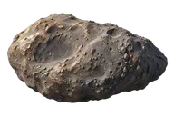 Small bodies16 Psyche222 km
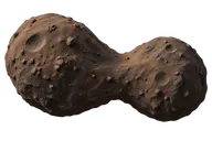 Small bodies624 Hektor225 km
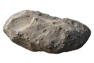 Small bodies15 Eunomia231.69 km
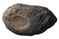 Small bodies88 Thisbe232 km
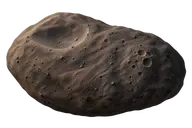 Small bodies65 Cybele237.26 km
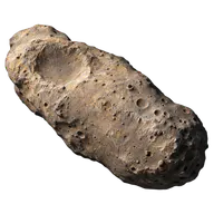 Small bodies3 Juno246.6 km
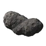 Small bodies87 Sylvia253.05 km
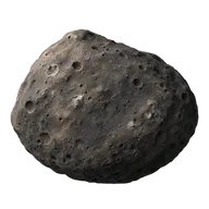 Small bodies451 Patientia253.9 km
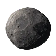 Small bodies31 Euphrosyne267.08 km
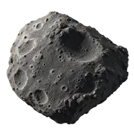 Small bodies511 Davida270.33 km
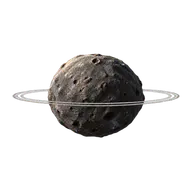 Small bodies10199 Chariklo302 km
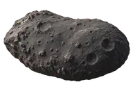 Small bodies52 Europa303.92 km
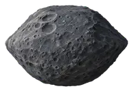 Small bodies704 Interamnia306.31 km
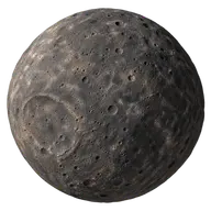 Small bodies10 Hygiea407.12 km
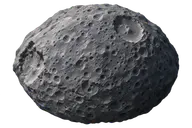 Small bodies2 Pallas513 km
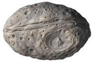 Small bodies4 Vesta522.77 km
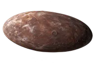 Small bodies20000 Varuna900 km
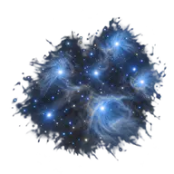
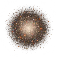
Star clusters
Stars
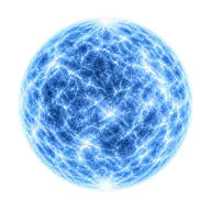 StarsNeutron star24 km
 StarsSirius B11,600 km
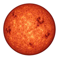 StarsProxima Centauri215,000 km
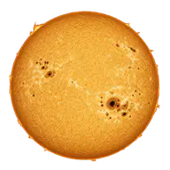 StarsSun1,392,700 km
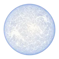 StarsSirius A2,380,000 km
 StarsVega3,300,000 km
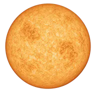 StarsPollux12,500,000 km
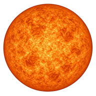 StarsArcturus35,000,000 km
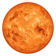 StarsAldebaran61,000,000 km
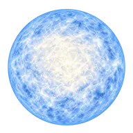 StarsRigel109,000,000 km
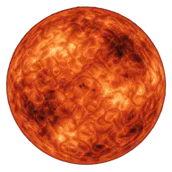 StarsAntares950,000,000 km
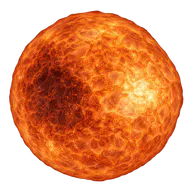 StarsV355 Cephei1.0714E9 kmStarsSU Persei1.0853E9 kmStarsIX Carinae1.0992E9 kmStarsTZ Cassiopeiae1.1131E9 kmStarsUY Scuti1.2648E9 kmStarsNR Vulpeculae1.3636E9 kmStarsRW Cygni1.3636E9 kmStarsBetelgeuse1.4E9 kmStarsKW Sagittarii1.4039E9 kmStarsV1749 Cygni1.4471E9 kmStarsVV Cephei A1.461E9 kmStarsCK Carinae1.4749E9 kmStarsV396 Centauri1.4888E9 kmStarsRT Carinae1.5166E9 kmStarsRW Cephei1.5305E9 kmStarsBC Cygni1.5862E9 kmStarsS Persei1.7114E9 kmStarsBI Cygni1.7253E9 kmStarsRSGC1-F021.7949E9 kmStarsHR 5171 A1.8297E9 kmStarsNML Cygni1.8784E9 kmStarsAH Scorpii1.9633E9 kmStarsMu Cephei1.9758E9 kmStarsVY Canis Majoris1.9758E9 kmStarsVX Sagittarii2.0259E9 kmStarsRSGC1-F012.0454E9 kmStarsWOH G64 A2.1428E9 kmStarsStephenson 2 DFK 12.5602E9 kmStarsMY Cephei2.8677E9 km
Illustration sources
Natural Earth (public domain)
Source coverage: Generalized map of the available published segments; it may be partial and include several branches. The documentary length is compared with the separate ruler, not with the width of the map. The complete course has not received individual hydrological certification. Natural Earth, public domain. Modified visualization: projection, generalized source trace, interpreted water/bank texture; 2026-11-04.
Natural Earth (public domain)
Source coverage: Generalized map of the available published segments; it may be partial and include several branches. The documentary length is compared with the separate ruler, not with the width of the map. The complete course has not received individual hydrological certification. Natural Earth, public domain. Modified visualization: projection, generalized source trace, interpreted water/bank texture; 2026-11-04.
How Big
Source coverage: Height of the tower alone; other monuments at the site excluded.
How Big
Source coverage: Side of the base plan, not the temple's height or a perspective diagonal.
How Big · interpreted illustration
Source coverage: Interpreted architectural profile; only the documented length of 183 m is calibrated, not a certified architectural reconstruction.
How Big
Source coverage: Architectural height to the tips, not the width of the pair or the height of the skybridge.
How Big
Source coverage: Interpreted general profile; secondary details have not been individually surveyed.
Natural Earth (public domain)
Source coverage: Generalised main route, with coastlines and lakes from Natural Earth. Some current approaches, locks and parallel channels are not shown in detail. The map retains its geographical orientation; only the independent bar compares the documented length.
Natural Earth (public domain)
Source coverage: Generalised main route, with coastlines and lakes from Natural Earth. Some current approaches, locks and parallel channels are not shown in detail. The map retains its geographical orientation; only the independent bar compares the documented length.
How Big
Source coverage: Representative Ming section, not a map of the network; only the ruler carries the cumulative length.
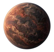
How Big — generated illustration; NASA/ESA documentation.
Source coverage: Visual interpretation; colours and texture do not constitute an observation. Only the designated extent follows the catalogue's reference value.
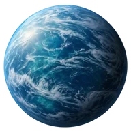
How Big — generated illustration; NASA/ESA documentation.
Source coverage: Visual interpretation; colours and texture do not constitute an observation. Only the designated extent follows the catalogue's reference value.
How Big
Source coverage: Interpreted illustration; only the designated dimension is calibrated.
How Big
Source coverage: Interpreted illustration; only the designated dimension is calibrated.
How Big
Source coverage: Interpreted illustration; only the designated dimension is calibrated.
How Big
Source coverage: Interpreted illustration; only the designated dimension is calibrated.
How Big
Source coverage: Interpreted illustration; only the designated dimension is calibrated.
How Big
Source coverage: Interpreted illustration; only the designated dimension is calibrated.
How Big — generated illustration; NASA/ESA documentary references.
Source coverage: Interpreted reconstruction; brightness, colours and textures are not an observation. Only the designated dimension uses the catalogue's representative value.
How Big — generated illustration; NASA/ESA documentary references.
Source coverage: Interpreted reconstruction; brightness, colours and textures are not an observation. Only the designated dimension uses the catalogue's representative value.
How Big — generated illustration; NASA/ESA documentary references.
Source coverage: Interpreted reconstruction; brightness, colours and textures are not an observation. Only the designated dimension uses the catalogue's representative value.
IGN/OFB · BD TOPAGE 2024 (Open Licence 2.0; modified)
Source coverage: Generalised map view of the available published segments; it may be partial and include several branches. The documented length is compared using the independent bar, not the map width. No individual hydrological certification of the entire course. BD TOPAGE2024 © IGN/OFB, SANDRE; generalized department overview prepared by Deepak420-GrandMaster/France-River-Flow-Map. Modified visualization: projection, generalized source trace, interpreted water/bank texture; 2026-11-04.
Natural Earth (public domain)
Source coverage: Generalized map of the available published segments; it may be partial and include several branches. The documentary length is compared with the separate ruler, not with the width of the map. The complete course has not received individual hydrological certification. Natural Earth, public domain. Modified visualization: projection, generalized source trace, interpreted water/bank texture; 2026-11-04.
Natural Earth (public domain)
Source coverage: Generalized map of the available published segments; it may be partial and include several branches. The documentary length is compared with the separate ruler, not with the width of the map. The complete course has not received individual hydrological certification. Natural Earth, public domain. Modified visualization: projection, generalized source trace, interpreted water/bank texture; 2026-11-04.
Natural Earth (public domain)
Source coverage: Generalized map of the available published segments; it may be partial and include several branches. The documentary length is compared with the separate ruler, not with the width of the map. The complete course has not received individual hydrological certification. Natural Earth, public domain. Modified visualization: projection, generalized source trace, interpreted water/bank texture; 2026-11-04.
Natural Earth (public domain)
Source coverage: Generalized map of the available published segments; it may be partial and include several branches. The documentary length is compared with the separate ruler, not with the width of the map. The complete course has not received individual hydrological certification. Natural Earth, public domain. Modified visualization: projection, generalized source trace, interpreted water/bank texture; 2026-11-04.
Natural Earth (public domain)
Source coverage: Generalized map of the available published segments; it may be partial and include several branches. The documentary length is compared with the separate ruler, not with the width of the map. The complete course has not received individual hydrological certification. Natural Earth, public domain. Modified visualization: projection, generalized source trace, interpreted water/bank texture; 2026-11-04.
© Geoscience Australia (CC BY 4.0; modified)
Source coverage: Generalised map view of the available published segments; it may be partial and include several branches. The documented length is compared using the independent bar, not the map width. No individual hydrological certification of the entire course. © Commonwealth of Australia (Geoscience Australia), Surface Hydrology Lines (Regional); named-stream OSM extraction by FrakGart/ga_streams. Modified visualization: projection, generalized source trace, interpreted water/bank texture; 2026-11-04.
- Source 1 · howbig.space
- Source 2 · github.com
- Source 3 · creativecommons.org
- Source 4 · pid.geoscience.gov.au
- Source 5 · raw.githubusercontent.com
- Source 6 · github.com
- Source 7 · raw.githubusercontent.com
- Source 8 · github.com
- Source 9 · raw.githubusercontent.com
- Source 10 · github.com
- Source 11 · raw.githubusercontent.com
- Source 12 · github.com
- Source 13 · raw.githubusercontent.com
- Source 14 · github.com
- Source 15 · raw.githubusercontent.com
- Source 16 · github.com
Natural Earth (public domain)
Source coverage: Generalized map of the available published segments; it may be partial and include several branches. The documentary length is compared with the separate ruler, not with the width of the map. The complete course has not received individual hydrological certification. Natural Earth, public domain. Modified visualization: projection, generalized source trace, interpreted water/bank texture; 2026-11-04.
Natural Earth (public domain)
Source coverage: Generalized map of the available published segments; it may be partial and include several branches. The documentary length is compared with the separate ruler, not with the width of the map. The complete course has not received individual hydrological certification. Natural Earth, public domain. Modified visualization: projection, generalized source trace, interpreted water/bank texture; 2026-11-04.
Natural Earth (public domain)
Source coverage: Generalized map of the available published segments; it may be partial and include several branches. The documentary length is compared with the separate ruler, not with the width of the map. The complete course has not received individual hydrological certification. Natural Earth, public domain. Modified visualization: projection, generalized source trace, interpreted water/bank texture; 2026-11-04.
Natural Earth (public domain)
Source coverage: Generalized map of the available published segments; it may be partial and include several branches. The documentary length is compared with the separate ruler, not with the width of the map. The complete course has not received individual hydrological certification. Natural Earth, public domain. Modified visualization: projection, generalized source trace, interpreted water/bank texture; 2026-11-04.
Natural Earth (public domain)
Source coverage: Generalized map of the available published segments; it may be partial and include several branches. The documentary length is compared with the separate ruler, not with the width of the map. The complete course has not received individual hydrological certification. Natural Earth, public domain. Modified visualization: projection, generalized source trace, interpreted water/bank texture; 2026-11-04.
Natural Earth (public domain)
Source coverage: Generalized map of the available published segments; it may be partial and include several branches. The documentary length is compared with the separate ruler, not with the width of the map. The complete course has not received individual hydrological certification. Natural Earth, public domain. Modified visualization: projection, generalized source trace, interpreted water/bank texture; 2026-11-04.
Natural Earth (public domain)
Source coverage: Generalized map of the available published segments; it may be partial and include several branches. The documentary length is compared with the separate ruler, not with the width of the map. The complete course has not received individual hydrological certification. Natural Earth, public domain. Modified visualization: projection, generalized source trace, interpreted water/bank texture; 2026-11-04.
Natural Earth (public domain)
Source coverage: Generalized map of the available published segments; it may be partial and include several branches. The documentary length is compared with the separate ruler, not with the width of the map. The complete course has not received individual hydrological certification. Natural Earth, public domain. Modified visualization: projection, generalized source trace, interpreted water/bank texture; 2026-11-04.
Natural Earth (public domain)
Source coverage: Generalized map of the available published segments; it may be partial and include several branches. The documentary length is compared with the separate ruler, not with the width of the map. The complete course has not received individual hydrological certification. Natural Earth, public domain. Modified visualization: projection, generalized source trace, interpreted water/bank texture; 2026-11-04.
Natural Earth (public domain)
Source coverage: Generalized map of the available published segments; it may be partial and include several branches. The documentary length is compared with the separate ruler, not with the width of the map. The complete course has not received individual hydrological certification. Natural Earth, public domain. Modified visualization: projection, generalized source trace, interpreted water/bank texture; 2026-11-04.
Natural Earth (public domain)
Source coverage: Generalized map of the available published segments; it may be partial and include several branches. The documentary length is compared with the separate ruler, not with the width of the map. The complete course has not received individual hydrological certification. Natural Earth, public domain. Modified visualization: projection, generalized source trace, interpreted water/bank texture; 2026-11-04.
Natural Earth (public domain)
Source coverage: Generalized map of the available published segments; it may be partial and include several branches. The documentary length is compared with the separate ruler, not with the width of the map. The complete course has not received individual hydrological certification. Natural Earth, public domain. Modified visualization: projection, generalized source trace, interpreted water/bank texture; 2026-11-04.
Natural Earth (public domain)
Source coverage: Generalized map of the available published segments; it may be partial and include several branches. The documentary length is compared with the separate ruler, not with the width of the map. The complete course has not received individual hydrological certification. Natural Earth, public domain. Modified visualization: projection, generalized source trace, interpreted water/bank texture; 2026-11-04.
Natural Earth (public domain)
Source coverage: Generalized map of the available published segments; it may be partial and include several branches. The documentary length is compared with the separate ruler, not with the width of the map. The complete course has not received individual hydrological certification. Natural Earth, public domain. Modified visualization: projection, generalized source trace, interpreted water/bank texture; 2026-11-04.
Natural Earth (public domain)
Source coverage: Generalized map of the available published segments; it may be partial and include several branches. The documentary length is compared with the separate ruler, not with the width of the map. The complete course has not received individual hydrological certification. Natural Earth, public domain. Modified visualization: projection, generalized source trace, interpreted water/bank texture; 2026-11-04.
Natural Earth (public domain)
Source coverage: Generalized map of the available published segments; it may be partial and include several branches. The documentary length is compared with the separate ruler, not with the width of the map. The complete course has not received individual hydrological certification. Natural Earth, public domain. Modified visualization: projection, generalized source trace, interpreted water/bank texture; 2026-11-04.
Natural Earth (public domain)
Source coverage: Generalized map of the available published segments; it may be partial and include several branches. The documentary length is compared with the separate ruler, not with the width of the map. The complete course has not received individual hydrological certification. Natural Earth, public domain. Modified visualization: projection, generalized source trace, interpreted water/bank texture; 2026-11-04.
Natural Earth (public domain)
Source coverage: Generalized map of the available published segments; it may be partial and include several branches. The documentary length is compared with the separate ruler, not with the width of the map. The complete course has not received individual hydrological certification. Natural Earth, public domain. Modified visualization: projection, generalized source trace, interpreted water/bank texture; 2026-11-04.
Natural Earth / © OpenStreetMap contributors (ODbL 1.0)
Source coverage: Generalised map view of the available published segments; it may be partial and include several branches. The documented length is compared using the independent bar, not the width of the map. No individual hydrological certification of the entire course. Geofreak; Natural Earth (public domain) / © OpenStreetMap contributors (ODbL 1.0). Upstream per-file origin is not individually certified. Modified visualization: projection, generalized source trace, interpreted water/bank texture; 2026-11-04.
Natural Earth (public domain)
Source coverage: Generalized map of the available published segments; it may be partial and include several branches. The documentary length is compared with the separate ruler, not with the width of the map. The complete course has not received individual hydrological certification. Natural Earth, public domain. Modified visualization: projection, generalized source trace, interpreted water/bank texture; 2026-11-04.
Natural Earth (public domain)
Source coverage: Generalized map of the available published segments; it may be partial and include several branches. The documentary length is compared with the separate ruler, not with the width of the map. The complete course has not received individual hydrological certification. Natural Earth, public domain. Modified visualization: projection, generalized source trace, interpreted water/bank texture; 2026-11-04.
Natural Earth (public domain)
Source coverage: Generalized map of the available published segments; it may be partial and include several branches. The documentary length is compared with the separate ruler, not with the width of the map. The complete course has not received individual hydrological certification. Natural Earth, public domain. Modified visualization: projection, generalized source trace, interpreted water/bank texture; 2026-11-04.
Natural Earth (public domain)
Source coverage: Generalized map of the available published segments; it may be partial and include several branches. The documentary length is compared with the separate ruler, not with the width of the map. The complete course has not received individual hydrological certification. Natural Earth, public domain. Modified visualization: projection, generalized source trace, interpreted water/bank texture; 2026-11-04.
Natural Earth (public domain)
Source coverage: Generalized map of the available published segments; it may be partial and include several branches. The documentary length is compared with the separate ruler, not with the width of the map. The complete course has not received individual hydrological certification. Natural Earth, public domain. Modified visualization: projection, generalized source trace, interpreted water/bank texture; 2026-11-04.
Natural Earth (public domain)
Source coverage: Generalized map of the available published segments; it may be partial and include several branches. The documentary length is compared with the separate ruler, not with the width of the map. The complete course has not received individual hydrological certification. Natural Earth, public domain. Modified visualization: projection, generalized source trace, interpreted water/bank texture; 2026-11-04.
Natural Earth (public domain)
Source coverage: Generalized map of the available published segments; it may be partial and include several branches. The documentary length is compared with the separate ruler, not with the width of the map. The complete course has not received individual hydrological certification. Natural Earth, public domain. Modified visualization: projection, generalized source trace, interpreted water/bank texture; 2026-11-04.
Natural Earth (public domain)
Source coverage: Generalized map of the available published segments; it may be partial and include several branches. The documentary length is compared with the separate ruler, not with the width of the map. The complete course has not received individual hydrological certification. Natural Earth, public domain. Modified visualization: projection, generalized source trace, interpreted water/bank texture; 2026-11-04.
Natural Earth (public domain)
Source coverage: Generalized map of the available published segments; it may be partial and include several branches. The documentary length is compared with the separate ruler, not with the width of the map. The complete course has not received individual hydrological certification. Natural Earth, public domain. Modified visualization: projection, generalized source trace, interpreted water/bank texture; 2026-11-04.
Natural Earth (public domain)
Source coverage: Generalized map of the available published segments; it may be partial and include several branches. The documentary length is compared with the separate ruler, not with the width of the map. The complete course has not received individual hydrological certification. Natural Earth, public domain. Modified visualization: projection, generalized source trace, interpreted water/bank texture; 2026-11-04.
Natural Earth / © OpenStreetMap contributors (ODbL 1.0)
Source coverage: Generalised map view of the available published segments; it may be partial and include several branches. The documented length is compared using the independent bar, not the width of the map. No individual hydrological certification of the entire course. Geofreak; Natural Earth (public domain) / © OpenStreetMap contributors (ODbL 1.0). Upstream per-file origin is not individually certified. Modified visualization: projection, generalized source trace, interpreted water/bank texture; 2026-11-04.
Natural Earth (public domain)
Source coverage: Generalized map of the available published segments; it may be partial and include several branches. The documentary length is compared with the separate ruler, not with the width of the map. The complete course has not received individual hydrological certification. Natural Earth, public domain. Modified visualization: projection, generalized source trace, interpreted water/bank texture; 2026-11-04.
Natural Earth (public domain)
Source coverage: Generalized map of the available published segments; it may be partial and include several branches. The documentary length is compared with the separate ruler, not with the width of the map. The complete course has not received individual hydrological certification. Natural Earth, public domain. Modified visualization: projection, generalized source trace, interpreted water/bank texture; 2026-11-04.
Natural Earth (public domain)
Source coverage: Generalized map of the available published segments; it may be partial and include several branches. The documentary length is compared with the separate ruler, not with the width of the map. The complete course has not received individual hydrological certification. Natural Earth, public domain. Modified visualization: projection, generalized source trace, interpreted water/bank texture; 2026-11-04.
Natural Earth (public domain)
Source coverage: Generalized map of the available published segments; it may be partial and include several branches. The documentary length is compared with the separate ruler, not with the width of the map. The complete course has not received individual hydrological certification. Natural Earth, public domain. Modified visualization: projection, generalized source trace, interpreted water/bank texture; 2026-11-04.
Natural Earth (public domain)
Source coverage: Generalized map of the available published segments; it may be partial and include several branches. The documentary length is compared with the separate ruler, not with the width of the map. The complete course has not received individual hydrological certification. Natural Earth, public domain. Modified visualization: projection, generalized source trace, interpreted water/bank texture; 2026-11-04.
Natural Earth (public domain)
Source coverage: Generalized map of the available published segments; it may be partial and include several branches. The documentary length is compared with the separate ruler, not with the width of the map. The complete course has not received individual hydrological certification. Natural Earth, public domain. Modified visualization: projection, generalized source trace, interpreted water/bank texture; 2026-11-04.
Natural Earth (public domain)
Source coverage: Generalized map of the available published segments; it may be partial and include several branches. The documentary length is compared with the separate ruler, not with the width of the map. The complete course has not received individual hydrological certification. Natural Earth, public domain. Modified visualization: projection, generalized source trace, interpreted water/bank texture; 2026-11-04.
Natural Earth (public domain)
Source coverage: Generalized map of the available published segments; it may be partial and include several branches. The documentary length is compared with the separate ruler, not with the width of the map. The complete course has not received individual hydrological certification. Natural Earth, public domain. Modified visualization: projection, generalized source trace, interpreted water/bank texture; 2026-11-04.
Natural Earth (public domain)
Source coverage: Generalized map of the available published segments; it may be partial and include several branches. The documentary length is compared with the separate ruler, not with the width of the map. The complete course has not received individual hydrological certification. Natural Earth, public domain. Modified visualization: projection, generalized source trace, interpreted water/bank texture; 2026-11-04.
Natural Earth (public domain)
Source coverage: Generalized map of the available published segments; it may be partial and include several branches. The documentary length is compared with the separate ruler, not with the width of the map. The complete course has not received individual hydrological certification. Natural Earth, public domain. Modified visualization: projection, generalized source trace, interpreted water/bank texture; 2026-11-04.
Natural Earth (public domain)
Source coverage: Generalized map of the available published segments; it may be partial and include several branches. The documentary length is compared with the separate ruler, not with the width of the map. The complete course has not received individual hydrological certification. Natural Earth, public domain. Modified visualization: projection, generalized source trace, interpreted water/bank texture; 2026-11-04.
Natural Earth (public domain)
Source coverage: Generalized map of the available published segments; it may be partial and include several branches. The documentary length is compared with the separate ruler, not with the width of the map. The complete course has not received individual hydrological certification. Natural Earth, public domain. Modified visualization: projection, generalized source trace, interpreted water/bank texture; 2026-11-04.
Natural Earth (public domain)
Source coverage: Generalized map of the available published segments; it may be partial and include several branches. The documentary length is compared with the separate ruler, not with the width of the map. The complete course has not received individual hydrological certification. Natural Earth, public domain. Modified visualization: projection, generalized source trace, interpreted water/bank texture; 2026-11-04.
Natural Earth (public domain)
Source coverage: Generalized map of the available published segments; it may be partial and include several branches. The documentary length is compared with the separate ruler, not with the width of the map. The complete course has not received individual hydrological certification. Natural Earth, public domain. Modified visualization: projection, generalized source trace, interpreted water/bank texture; 2026-11-04.
Natural Earth (public domain)
Source coverage: Generalized map of the available published segments; it may be partial and include several branches. The documentary length is compared with the separate ruler, not with the width of the map. The complete course has not received individual hydrological certification. Natural Earth, public domain. Modified visualization: projection, generalized source trace, interpreted water/bank texture; 2026-11-04.
Natural Earth (public domain)
Source coverage: Generalized map of the available published segments; it may be partial and include several branches. The documentary length is compared with the separate ruler, not with the width of the map. The complete course has not received individual hydrological certification. Natural Earth, public domain. Modified visualization: projection, generalized source trace, interpreted water/bank texture; 2026-11-04.
Natural Earth (public domain)
Source coverage: Generalized map of the available published segments; it may be partial and include several branches. The documentary length is compared with the separate ruler, not with the width of the map. The complete course has not received individual hydrological certification. Natural Earth, public domain. Modified visualization: projection, generalized source trace, interpreted water/bank texture; 2026-11-04.
Natural Earth (public domain)
Source coverage: Generalized map of the available published segments; it may be partial and include several branches. The documentary length is compared with the separate ruler, not with the width of the map. The complete course has not received individual hydrological certification. Natural Earth, public domain. Modified visualization: projection, generalized source trace, interpreted water/bank texture; 2026-11-04.
Natural Earth (public domain)
Source coverage: Generalized map of the available published segments; it may be partial and include several branches. The documentary length is compared with the separate ruler, not with the width of the map. The complete course has not received individual hydrological certification. Natural Earth, public domain. Modified visualization: projection, generalized source trace, interpreted water/bank texture; 2026-11-04.
Natural Earth (public domain)
Source coverage: Generalized map of the available published segments; it may be partial and include several branches. The documentary length is compared with the separate ruler, not with the width of the map. The complete course has not received individual hydrological certification. Natural Earth, public domain. Modified visualization: projection, generalized source trace, interpreted water/bank texture; 2026-11-04.
Natural Earth (public domain)
Source coverage: Generalized map of the available published segments; it may be partial and include several branches. The documentary length is compared with the separate ruler, not with the width of the map. The complete course has not received individual hydrological certification. Natural Earth, public domain. Modified visualization: projection, generalized source trace, interpreted water/bank texture; 2026-11-04.
Natural Earth (public domain)
Source coverage: Generalized map of the available published segments; it may be partial and include several branches. The documentary length is compared with the separate ruler, not with the width of the map. The complete course has not received individual hydrological certification. Natural Earth, public domain. Modified visualization: projection, generalized source trace, interpreted water/bank texture; 2026-11-04.
Natural Earth (public domain)
Source coverage: Generalized map of the available published segments; it may be partial and include several branches. The documentary length is compared with the separate ruler, not with the width of the map. The complete course has not received individual hydrological certification. Natural Earth, public domain. Modified visualization: projection, generalized source trace, interpreted water/bank texture; 2026-11-04.
Natural Earth (public domain)
Source coverage: Generalized map of the available published segments; it may be partial and include several branches. The documentary length is compared with the separate ruler, not with the width of the map. The complete course has not received individual hydrological certification. Natural Earth, public domain. Modified visualization: projection, generalized source trace, interpreted water/bank texture; 2026-11-04.
Natural Earth (public domain)
Source coverage: Generalized map of the available published segments; it may be partial and include several branches. The documentary length is compared with the separate ruler, not with the width of the map. The complete course has not received individual hydrological certification. Natural Earth, public domain. Modified visualization: projection, generalized source trace, interpreted water/bank texture; 2026-11-04.
Natural Earth (public domain)
Source coverage: Generalized map of the available published segments; it may be partial and include several branches. The documentary length is compared with the separate ruler, not with the width of the map. The complete course has not received individual hydrological certification. Natural Earth, public domain. Modified visualization: projection, generalized source trace, interpreted water/bank texture; 2026-11-04.
Natural Earth (public domain)
Source coverage: Generalized map of the available published segments; it may be partial and include several branches. The documentary length is compared with the separate ruler, not with the width of the map. The complete course has not received individual hydrological certification. Natural Earth, public domain. Modified visualization: projection, generalized source trace, interpreted water/bank texture; 2026-11-04.
Natural Earth (public domain)
Source coverage: Generalized map of the available published segments; it may be partial and include several branches. The documentary length is compared with the separate ruler, not with the width of the map. The complete course has not received individual hydrological certification. Natural Earth, public domain. Modified visualization: projection, generalized source trace, interpreted water/bank texture; 2026-11-04.
Natural Earth (public domain)
Source coverage: Generalized map of the available published segments; it may be partial and include several branches. The documentary length is compared with the separate ruler, not with the width of the map. The complete course has not received individual hydrological certification. Natural Earth, public domain. Modified visualization: projection, generalized source trace, interpreted water/bank texture; 2026-11-04.
Natural Earth (public domain)
Source coverage: Generalized map of the available published segments; it may be partial and include several branches. The documentary length is compared with the separate ruler, not with the width of the map. The complete course has not received individual hydrological certification. Natural Earth, public domain. Modified visualization: projection, generalized source trace, interpreted water/bank texture; 2026-11-04.
Natural Earth (public domain)
Source coverage: Generalized map of the available published segments; it may be partial and include several branches. The documentary length is compared with the separate ruler, not with the width of the map. The complete course has not received individual hydrological certification. Natural Earth, public domain. Modified visualization: projection, generalized source trace, interpreted water/bank texture; 2026-11-04.
Natural Earth (public domain)
Source coverage: Generalized map of the available published segments; it may be partial and include several branches. The documentary length is compared with the separate ruler, not with the width of the map. The complete course has not received individual hydrological certification. Natural Earth, public domain. Modified visualization: projection, generalized source trace, interpreted water/bank texture; 2026-11-04.
Natural Earth (public domain)
Source coverage: Generalized map of the available published segments; it may be partial and include several branches. The documentary length is compared with the separate ruler, not with the width of the map. The complete course has not received individual hydrological certification. Natural Earth, public domain. Modified visualization: projection, generalized source trace, interpreted water/bank texture; 2026-11-04.
Natural Earth (public domain)
Source coverage: Generalized map of the available published segments; it may be partial and include several branches. The documentary length is compared with the separate ruler, not with the width of the map. The complete course has not received individual hydrological certification. Natural Earth, public domain. Modified visualization: projection, generalized source trace, interpreted water/bank texture; 2026-11-04.
Natural Earth (public domain)
Source coverage: Generalized map of the available published segments; it may be partial and include several branches. The documentary length is compared with the separate ruler, not with the width of the map. The complete course has not received individual hydrological certification. Natural Earth, public domain. Modified visualization: projection, generalized source trace, interpreted water/bank texture; 2026-11-04.
Natural Earth (public domain)
Source coverage: Generalized map of the available published segments; it may be partial and include several branches. The documentary length is compared with the separate ruler, not with the width of the map. The complete course has not received individual hydrological certification. Natural Earth, public domain. Modified visualization: projection, generalized source trace, interpreted water/bank texture; 2026-11-04.
Natural Earth (public domain)
Source coverage: Generalized map of the available published segments; it may be partial and include several branches. The documentary length is compared with the separate ruler, not with the width of the map. The complete course has not received individual hydrological certification. Natural Earth, public domain. Modified visualization: projection, generalized source trace, interpreted water/bank texture; 2026-11-04.
Natural Earth (public domain)
Source coverage: Generalized map of the available published segments; it may be partial and include several branches. The documentary length is compared with the separate ruler, not with the width of the map. The complete course has not received individual hydrological certification. Natural Earth, public domain. Modified visualization: projection, generalized source trace, interpreted water/bank texture; 2026-11-04.
Natural Earth (public domain)
Source coverage: Generalized map of the available published segments; it may be partial and include several branches. The documentary length is compared with the separate ruler, not with the width of the map. The complete course has not received individual hydrological certification. Natural Earth, public domain. Modified visualization: projection, generalized source trace, interpreted water/bank texture; 2026-11-04.
Natural Earth (public domain)
Source coverage: Generalized map of the available published segments; it may be partial and include several branches. The documentary length is compared with the separate ruler, not with the width of the map. The complete course has not received individual hydrological certification. Natural Earth, public domain. Modified visualization: projection, generalized source trace, interpreted water/bank texture; 2026-11-04.
Natural Earth (public domain)
Source coverage: Generalized map of the available published segments; it may be partial and include several branches. The documentary length is compared with the separate ruler, not with the width of the map. The complete course has not received individual hydrological certification. Natural Earth, public domain. Modified visualization: projection, generalized source trace, interpreted water/bank texture; 2026-11-04.
Natural Earth (public domain)
Source coverage: Generalized map of the available published segments; it may be partial and include several branches. The documentary length is compared with the separate ruler, not with the width of the map. The complete course has not received individual hydrological certification. Natural Earth, public domain. Modified visualization: projection, generalized source trace, interpreted water/bank texture; 2026-11-04.
Natural Earth (public domain)
Source coverage: Generalized map of the available published segments; it may be partial and include several branches. The documentary length is compared with the separate ruler, not with the width of the map. The complete course has not received individual hydrological certification. Natural Earth, public domain. Modified visualization: projection, generalized source trace, interpreted water/bank texture; 2026-11-04.
Natural Earth (public domain)
Source coverage: Generalized map of the available published segments; it may be partial and include several branches. The documentary length is compared with the separate ruler, not with the width of the map. The complete course has not received individual hydrological certification. Natural Earth, public domain. Modified visualization: projection, generalized source trace, interpreted water/bank texture; 2026-11-04.
Natural Earth (public domain)
Source coverage: Generalized map of the available published segments; it may be partial and include several branches. The documentary length is compared with the separate ruler, not with the width of the map. The complete course has not received individual hydrological certification. Natural Earth, public domain. Modified visualization: projection, generalized source trace, interpreted water/bank texture; 2026-11-04.
Natural Earth (public domain)
Source coverage: Generalized map of the available published segments; it may be partial and include several branches. The documentary length is compared with the separate ruler, not with the width of the map. The complete course has not received individual hydrological certification. Natural Earth, public domain. Modified visualization: projection, generalized source trace, interpreted water/bank texture; 2026-11-04.
Natural Earth (public domain)
Source coverage: Generalized map of the available published segments; it may be partial and include several branches. The documentary length is compared with the separate ruler, not with the width of the map. The complete course has not received individual hydrological certification. Natural Earth, public domain. Modified visualization: projection, generalized source trace, interpreted water/bank texture; 2026-11-04.
Natural Earth (public domain)
Source coverage: Generalized map of the available published segments; it may be partial and include several branches. The documentary length is compared with the separate ruler, not with the width of the map. The complete course has not received individual hydrological certification. Natural Earth, public domain. Modified visualization: projection, generalized source trace, interpreted water/bank texture; 2026-11-04.
Natural Earth (public domain)
Source coverage: Generalized map of the available published segments; it may be partial and include several branches. The documentary length is compared with the separate ruler, not with the width of the map. The complete course has not received individual hydrological certification. Natural Earth, public domain. Modified visualization: projection, generalized source trace, interpreted water/bank texture; 2026-11-04.
Natural Earth (public domain)
Source coverage: Generalized map of the available published segments; it may be partial and include several branches. The documentary length is compared with the separate ruler, not with the width of the map. The complete course has not received individual hydrological certification. Natural Earth, public domain. Modified visualization: projection, generalized source trace, interpreted water/bank texture; 2026-11-04.
Natural Earth (public domain)
Source coverage: Generalized map of the available published segments; it may be partial and include several branches. The documentary length is compared with the separate ruler, not with the width of the map. The complete course has not received individual hydrological certification. Natural Earth, public domain. Modified visualization: projection, generalized source trace, interpreted water/bank texture; 2026-11-04.
Natural Earth (public domain)
Source coverage: Generalized map of the available published segments; it may be partial and include several branches. The documentary length is compared with the separate ruler, not with the width of the map. The complete course has not received individual hydrological certification. Natural Earth, public domain. Modified visualization: projection, generalized source trace, interpreted water/bank texture; 2026-11-04.
Natural Earth (public domain)
Source coverage: Generalized map of the available published segments; it may be partial and include several branches. The documentary length is compared with the separate ruler, not with the width of the map. The complete course has not received individual hydrological certification. Natural Earth, public domain. Modified visualization: projection, generalized source trace, interpreted water/bank texture; 2026-11-04.
GSHHG/WDBII · Basemap (LGPL3+)
Source coverage: Generalised map view of the available published segments; it may be partial and include several branches. The documented length is compared using the independent bar, not the map width. No individual hydrological certification of the entire course. Historical WDBII route: its position is sometimes offset from modern observations; the source line length is independent of the documented reference of 1 300 km. GSHHG 2.3.6 / WDBII river linework, prepared with GMT 5.x and distributed by Matplotlib Basemap. Original source coordinates retained. Modified visualization: projection, generalized source trace, interpreted water/bank texture; 2026-11-04.
Natural Earth (public domain)
Source coverage: Generalized map of the available published segments; it may be partial and include several branches. The documentary length is compared with the separate ruler, not with the width of the map. The complete course has not received individual hydrological certification. Natural Earth, public domain. Modified visualization: projection, generalized source trace, interpreted water/bank texture; 2026-11-04.
Natural Earth (public domain)
Source coverage: Generalized map of the available published segments; it may be partial and include several branches. The documentary length is compared with the separate ruler, not with the width of the map. The complete course has not received individual hydrological certification. Natural Earth, public domain. Modified visualization: projection, generalized source trace, interpreted water/bank texture; 2026-11-04.
Natural Earth (public domain)
Source coverage: Generalized map of the available published segments; it may be partial and include several branches. The documentary length is compared with the separate ruler, not with the width of the map. The complete course has not received individual hydrological certification. Natural Earth, public domain. Modified visualization: projection, generalized source trace, interpreted water/bank texture; 2026-11-04.
Natural Earth (public domain)
Source coverage: Generalized map of the available published segments; it may be partial and include several branches. The documentary length is compared with the separate ruler, not with the width of the map. The complete course has not received individual hydrological certification. Natural Earth, public domain. Modified visualization: projection, generalized source trace, interpreted water/bank texture; 2026-11-04.
Natural Earth (public domain)
Source coverage: Generalized map of the available published segments; it may be partial and include several branches. The documentary length is compared with the separate ruler, not with the width of the map. The complete course has not received individual hydrological certification. Natural Earth, public domain. Modified visualization: projection, generalized source trace, interpreted water/bank texture; 2026-11-04.
Natural Earth / © OpenStreetMap contributors (ODbL 1.0)
Source coverage: Generalised map view of the available published segments; it may be partial and include several branches. The documented length is compared using the independent bar, not the width of the map. No individual hydrological certification of the entire course. Geofreak; Natural Earth (public domain) / © OpenStreetMap contributors (ODbL 1.0). Upstream per-file origin is not individually certified. Modified visualization: projection, generalized source trace, interpreted water/bank texture; 2026-11-04.
Natural Earth (public domain)
Source coverage: Generalized map of the available published segments; it may be partial and include several branches. The documentary length is compared with the separate ruler, not with the width of the map. The complete course has not received individual hydrological certification. Natural Earth, public domain. Modified visualization: projection, generalized source trace, interpreted water/bank texture; 2026-11-04.
Natural Earth (public domain)
Source coverage: Generalized map of the available published segments; it may be partial and include several branches. The documentary length is compared with the separate ruler, not with the width of the map. The complete course has not received individual hydrological certification. Natural Earth, public domain. Modified visualization: projection, generalized source trace, interpreted water/bank texture; 2026-11-04.
Natural Earth (public domain)
Source coverage: Generalized map of the available published segments; it may be partial and include several branches. The documentary length is compared with the separate ruler, not with the width of the map. The complete course has not received individual hydrological certification. Natural Earth, public domain. Modified visualization: projection, generalized source trace, interpreted water/bank texture; 2026-11-04.
Natural Earth (public domain)
Source coverage: Generalized map of the available published segments; it may be partial and include several branches. The documentary length is compared with the separate ruler, not with the width of the map. The complete course has not received individual hydrological certification. Natural Earth, public domain. Modified visualization: projection, generalized source trace, interpreted water/bank texture; 2026-11-04.
Natural Earth (public domain)
Source coverage: Generalized map of the available published segments; it may be partial and include several branches. The documentary length is compared with the separate ruler, not with the width of the map. The complete course has not received individual hydrological certification. Natural Earth, public domain. Modified visualization: projection, generalized source trace, interpreted water/bank texture; 2026-11-04.
Natural Earth (public domain)
Source coverage: Generalized map of the available published segments; it may be partial and include several branches. The documentary length is compared with the separate ruler, not with the width of the map. The complete course has not received individual hydrological certification. Natural Earth, public domain. Modified visualization: projection, generalized source trace, interpreted water/bank texture; 2026-11-04.
Natural Earth (public domain)
Source coverage: Generalized map of the available published segments; it may be partial and include several branches. The documentary length is compared with the separate ruler, not with the width of the map. The complete course has not received individual hydrological certification. Natural Earth, public domain. Modified visualization: projection, generalized source trace, interpreted water/bank texture; 2026-11-04.
Natural Earth (public domain)
Source coverage: Generalized map of the available published segments; it may be partial and include several branches. The documentary length is compared with the separate ruler, not with the width of the map. The complete course has not received individual hydrological certification. Natural Earth, public domain. Modified visualization: projection, generalized source trace, interpreted water/bank texture; 2026-11-04.
Natural Earth (public domain)
Source coverage: Generalized map of the available published segments; it may be partial and include several branches. The documentary length is compared with the separate ruler, not with the width of the map. The complete course has not received individual hydrological certification. Natural Earth, public domain. Modified visualization: projection, generalized source trace, interpreted water/bank texture; 2026-11-04.
Natural Earth (public domain)
Source coverage: Generalized map of the available published segments; it may be partial and include several branches. The documentary length is compared with the separate ruler, not with the width of the map. The complete course has not received individual hydrological certification. Natural Earth, public domain. Modified visualization: projection, generalized source trace, interpreted water/bank texture; 2026-11-04.
Natural Earth (public domain)
Source coverage: Generalized map of the available published segments; it may be partial and include several branches. The documentary length is compared with the separate ruler, not with the width of the map. The complete course has not received individual hydrological certification. Natural Earth, public domain. Modified visualization: projection, generalized source trace, interpreted water/bank texture; 2026-11-04.
Natural Earth (public domain)
Source coverage: Generalized map of the available published segments; it may be partial and include several branches. The documentary length is compared with the separate ruler, not with the width of the map. The complete course has not received individual hydrological certification. Natural Earth, public domain. Modified visualization: projection, generalized source trace, interpreted water/bank texture; 2026-11-04.
Natural Earth (public domain)
Source coverage: Generalized map of the available published segments; it may be partial and include several branches. The documentary length is compared with the separate ruler, not with the width of the map. The complete course has not received individual hydrological certification. Natural Earth, public domain. Modified visualization: projection, generalized source trace, interpreted water/bank texture; 2026-11-04.
Natural Earth (public domain)
Source coverage: Generalized map of the available published segments; it may be partial and include several branches. The documentary length is compared with the separate ruler, not with the width of the map. The complete course has not received individual hydrological certification. Natural Earth, public domain. Modified visualization: projection, generalized source trace, interpreted water/bank texture; 2026-11-04.
Natural Earth (public domain)
Source coverage: Generalized map of the available published segments; it may be partial and include several branches. The documentary length is compared with the separate ruler, not with the width of the map. The complete course has not received individual hydrological certification. Natural Earth, public domain. Modified visualization: projection, generalized source trace, interpreted water/bank texture; 2026-11-04.
Natural Earth (public domain)
Source coverage: Generalized map of the available published segments; it may be partial and include several branches. The documentary length is compared with the separate ruler, not with the width of the map. The complete course has not received individual hydrological certification. Natural Earth, public domain. Modified visualization: projection, generalized source trace, interpreted water/bank texture; 2026-11-04.
Natural Earth (public domain)
Source coverage: Generalized map of the available published segments; it may be partial and include several branches. The documentary length is compared with the separate ruler, not with the width of the map. The complete course has not received individual hydrological certification. Natural Earth, public domain. Modified visualization: projection, generalized source trace, interpreted water/bank texture; 2026-11-04.
© Geoscience Australia (CC BY 4.0; modified)
Source coverage: Generalised map view of the available published segments; it may be partial and include several branches. The documented length is compared using the independent bar, not the map width. No individual hydrological certification of the entire course. © Commonwealth of Australia (Geoscience Australia), Surface Hydrology Lines (Regional); named-stream OSM extraction by FrakGart/ga_streams. Modified visualization: projection, generalized source trace, interpreted water/bank texture; 2026-11-04.
- Source 1 · howbig.space
- Source 2 · github.com
- Source 3 · creativecommons.org
- Source 4 · pid.geoscience.gov.au
- Source 5 · raw.githubusercontent.com
- Source 6 · github.com
- Source 7 · raw.githubusercontent.com
- Source 8 · github.com
- Source 9 · raw.githubusercontent.com
- Source 10 · github.com
- Source 11 · raw.githubusercontent.com
- Source 12 · github.com
- Source 13 · raw.githubusercontent.com
- Source 14 · github.com
- Source 15 · raw.githubusercontent.com
- Source 16 · github.com
Natural Earth (public domain)
Source coverage: Generalized map of the available published segments; it may be partial and include several branches. The documentary length is compared with the separate ruler, not with the width of the map. The complete course has not received individual hydrological certification. Natural Earth, public domain. Modified visualization: projection, generalized source trace, interpreted water/bank texture; 2026-11-04.
Natural Earth (public domain)
Source coverage: Generalized map of the available published segments; it may be partial and include several branches. The documentary length is compared with the separate ruler, not with the width of the map. The complete course has not received individual hydrological certification. Natural Earth, public domain. Modified visualization: projection, generalized source trace, interpreted water/bank texture; 2026-11-04.
Natural Earth (public domain)
Source coverage: Generalized map of the available published segments; it may be partial and include several branches. The documentary length is compared with the separate ruler, not with the width of the map. The complete course has not received individual hydrological certification. Natural Earth, public domain. Modified visualization: projection, generalized source trace, interpreted water/bank texture; 2026-11-04.
© Geoscience Australia (CC BY 4.0; modified)
Source coverage: Generalised map view of the available published segments; it may be partial and include several branches. The documented length is compared using the independent bar, not the map width. No individual hydrological certification of the entire course. © Commonwealth of Australia (Geoscience Australia), Surface Hydrology Lines (Regional); named-stream OSM extraction by FrakGart/ga_streams. Modified visualization: projection, generalized source trace, interpreted water/bank texture; 2026-11-04.
- Source 1 · howbig.space
- Source 2 · github.com
- Source 3 · creativecommons.org
- Source 4 · pid.geoscience.gov.au
- Source 5 · raw.githubusercontent.com
- Source 6 · github.com
- Source 7 · raw.githubusercontent.com
- Source 8 · github.com
- Source 9 · raw.githubusercontent.com
- Source 10 · github.com
- Source 11 · raw.githubusercontent.com
- Source 12 · github.com
- Source 13 · raw.githubusercontent.com
- Source 14 · github.com
- Source 15 · raw.githubusercontent.com
- Source 16 · github.com
Natural Earth (public domain)
Source coverage: Generalized map of the available published segments; it may be partial and include several branches. The documentary length is compared with the separate ruler, not with the width of the map. The complete course has not received individual hydrological certification. Natural Earth, public domain. Modified visualization: projection, generalized source trace, interpreted water/bank texture; 2026-11-04.
Natural Earth (public domain)
Source coverage: Generalized map of the available published segments; it may be partial and include several branches. The documentary length is compared with the separate ruler, not with the width of the map. The complete course has not received individual hydrological certification. Natural Earth, public domain. Modified visualization: projection, generalized source trace, interpreted water/bank texture; 2026-11-04.
Natural Earth (public domain)
Source coverage: Generalized map of the available published segments; it may be partial and include several branches. The documentary length is compared with the separate ruler, not with the width of the map. The complete course has not received individual hydrological certification. Natural Earth, public domain. Modified visualization: projection, generalized source trace, interpreted water/bank texture; 2026-11-04.
Natural Earth (public domain)
Source coverage: Generalized map of the available published segments; it may be partial and include several branches. The documentary length is compared with the separate ruler, not with the width of the map. The complete course has not received individual hydrological certification. Natural Earth, public domain. Modified visualization: projection, generalized source trace, interpreted water/bank texture; 2026-11-04.
Natural Earth (public domain)
Source coverage: Generalized map of the available published segments; it may be partial and include several branches. The documentary length is compared with the separate ruler, not with the width of the map. The complete course has not received individual hydrological certification. Natural Earth, public domain. Modified visualization: projection, generalized source trace, interpreted water/bank texture; 2026-11-04.
Natural Earth (public domain)
Source coverage: Generalized map of the available published segments; it may be partial and include several branches. The documentary length is compared with the separate ruler, not with the width of the map. The complete course has not received individual hydrological certification. Natural Earth, public domain. Modified visualization: projection, generalized source trace, interpreted water/bank texture; 2026-11-04.
Natural Earth (public domain)
Source coverage: Generalized map of the available published segments; it may be partial and include several branches. The documentary length is compared with the separate ruler, not with the width of the map. The complete course has not received individual hydrological certification. Natural Earth, public domain. Modified visualization: projection, generalized source trace, interpreted water/bank texture; 2026-11-04.
Natural Earth (public domain)
Source coverage: Generalized map of the available published segments; it may be partial and include several branches. The documentary length is compared with the separate ruler, not with the width of the map. The complete course has not received individual hydrological certification. Natural Earth, public domain. Modified visualization: projection, generalized source trace, interpreted water/bank texture; 2026-11-04.
Natural Earth (public domain)
Source coverage: Generalized map of the available published segments; it may be partial and include several branches. The documentary length is compared with the separate ruler, not with the width of the map. The complete course has not received individual hydrological certification. Natural Earth, public domain. Modified visualization: projection, generalized source trace, interpreted water/bank texture; 2026-11-04.
© Geoscience Australia (CC BY 4.0; modified)
Source coverage: Generalised map view of the available published segments; it may be partial and include several branches. The documented length is compared using the independent bar, not the map width. No individual hydrological certification of the entire course. © Commonwealth of Australia (Geoscience Australia), Surface Hydrology Lines (Regional); named-stream OSM extraction by FrakGart/ga_streams. Modified visualization: projection, generalized source trace, interpreted water/bank texture; 2026-11-04.
- Source 1 · howbig.space
- Source 2 · github.com
- Source 3 · creativecommons.org
- Source 4 · pid.geoscience.gov.au
- Source 5 · raw.githubusercontent.com
- Source 6 · github.com
- Source 7 · raw.githubusercontent.com
- Source 8 · github.com
- Source 9 · raw.githubusercontent.com
- Source 10 · github.com
- Source 11 · raw.githubusercontent.com
- Source 12 · github.com
- Source 13 · raw.githubusercontent.com
- Source 14 · github.com
- Source 15 · raw.githubusercontent.com
- Source 16 · github.com
Natural Earth (public domain)
Source coverage: Generalized map of the available published segments; it may be partial and include several branches. The documentary length is compared with the separate ruler, not with the width of the map. The complete course has not received individual hydrological certification. Natural Earth, public domain. Modified visualization: projection, generalized source trace, interpreted water/bank texture; 2026-11-04.
Natural Earth (public domain)
Source coverage: Generalized map of the available published segments; it may be partial and include several branches. The documentary length is compared with the separate ruler, not with the width of the map. The complete course has not received individual hydrological certification. Natural Earth, public domain. Modified visualization: projection, generalized source trace, interpreted water/bank texture; 2026-11-04.
© Geoscience Australia (CC BY 4.0; modified)
Source coverage: Generalised map view of the available published segments; it may be partial and include several branches. The documented length is compared using the independent bar, not the map width. No individual hydrological certification of the entire course. © Commonwealth of Australia (Geoscience Australia), Surface Hydrology Lines (Regional); named-stream OSM extraction by FrakGart/ga_streams. Modified visualization: projection, generalized source trace, interpreted water/bank texture; 2026-11-04.
- Source 1 · howbig.space
- Source 2 · github.com
- Source 3 · creativecommons.org
- Source 4 · pid.geoscience.gov.au
- Source 5 · raw.githubusercontent.com
- Source 6 · github.com
- Source 7 · raw.githubusercontent.com
- Source 8 · github.com
- Source 9 · raw.githubusercontent.com
- Source 10 · github.com
- Source 11 · raw.githubusercontent.com
- Source 12 · github.com
- Source 13 · raw.githubusercontent.com
- Source 14 · github.com
- Source 15 · raw.githubusercontent.com
- Source 16 · github.com
Natural Earth (public domain)
Source coverage: Generalized map of the available published segments; it may be partial and include several branches. The documentary length is compared with the separate ruler, not with the width of the map. The complete course has not received individual hydrological certification. Natural Earth, public domain. Modified visualization: projection, generalized source trace, interpreted water/bank texture; 2026-11-04.
Natural Earth (public domain)
Source coverage: Generalized map of the available published segments; it may be partial and include several branches. The documentary length is compared with the separate ruler, not with the width of the map. The complete course has not received individual hydrological certification. Natural Earth, public domain. Modified visualization: projection, generalized source trace, interpreted water/bank texture; 2026-11-04.
Natural Earth (public domain)
Source coverage: Generalized map of the available published segments; it may be partial and include several branches. The documentary length is compared with the separate ruler, not with the width of the map. The complete course has not received individual hydrological certification. Natural Earth, public domain. Modified visualization: projection, generalized source trace, interpreted water/bank texture; 2026-11-04.
Natural Earth (public domain)
Source coverage: Generalized map of the available published segments; it may be partial and include several branches. The documentary length is compared with the separate ruler, not with the width of the map. The complete course has not received individual hydrological certification. Natural Earth, public domain. Modified visualization: projection, generalized source trace, interpreted water/bank texture; 2026-11-04.
Natural Earth (public domain)
Source coverage: Generalized map of the available published segments; it may be partial and include several branches. The documentary length is compared with the separate ruler, not with the width of the map. The complete course has not received individual hydrological certification. Natural Earth, public domain. Modified visualization: projection, generalized source trace, interpreted water/bank texture; 2026-11-04.
Natural Earth (public domain)
Source coverage: Generalized map of the available published segments; it may be partial and include several branches. The documentary length is compared with the separate ruler, not with the width of the map. The complete course has not received individual hydrological certification. Natural Earth, public domain. Modified visualization: projection, generalized source trace, interpreted water/bank texture; 2026-11-04.
Natural Earth (public domain)
Source coverage: Generalized map of the available published segments; it may be partial and include several branches. The documentary length is compared with the separate ruler, not with the width of the map. The complete course has not received individual hydrological certification. Natural Earth, public domain. Modified visualization: projection, generalized source trace, interpreted water/bank texture; 2026-11-04.
Natural Earth (public domain)
Source coverage: Generalized map of the available published segments; it may be partial and include several branches. The documentary length is compared with the separate ruler, not with the width of the map. The complete course has not received individual hydrological certification. Natural Earth, public domain. Modified visualization: projection, generalized source trace, interpreted water/bank texture; 2026-11-04.
Natural Earth (public domain)
Source coverage: Generalized map of the available published segments; it may be partial and include several branches. The documentary length is compared with the separate ruler, not with the width of the map. The complete course has not received individual hydrological certification. Natural Earth, public domain. Modified visualization: projection, generalized source trace, interpreted water/bank texture; 2026-11-04.
Natural Earth (public domain)
Source coverage: Generalized map of the available published segments; it may be partial and include several branches. The documentary length is compared with the separate ruler, not with the width of the map. The complete course has not received individual hydrological certification. Natural Earth, public domain. Modified visualization: projection, generalized source trace, interpreted water/bank texture; 2026-11-04.
Natural Earth (public domain)
Source coverage: Generalized map of the available published segments; it may be partial and include several branches. The documentary length is compared with the separate ruler, not with the width of the map. The complete course has not received individual hydrological certification. Natural Earth, public domain. Modified visualization: projection, generalized source trace, interpreted water/bank texture; 2026-11-04.
Natural Earth (public domain)
Source coverage: Generalized map of the available published segments; it may be partial and include several branches. The documentary length is compared with the separate ruler, not with the width of the map. The complete course has not received individual hydrological certification. Natural Earth, public domain. Modified visualization: projection, generalized source trace, interpreted water/bank texture; 2026-11-04.
Natural Earth (public domain)
Source coverage: Generalized map of the available published segments; it may be partial and include several branches. The documentary length is compared with the separate ruler, not with the width of the map. The complete course has not received individual hydrological certification. Natural Earth, public domain. Modified visualization: projection, generalized source trace, interpreted water/bank texture; 2026-11-04.
Natural Earth (public domain)
Source coverage: Generalized map of the available published segments; it may be partial and include several branches. The documentary length is compared with the separate ruler, not with the width of the map. The complete course has not received individual hydrological certification. Natural Earth, public domain. Modified visualization: projection, generalized source trace, interpreted water/bank texture; 2026-11-04.
Natural Earth (public domain)
Source coverage: Generalized map of the available published segments; it may be partial and include several branches. The documentary length is compared with the separate ruler, not with the width of the map. The complete course has not received individual hydrological certification. Natural Earth, public domain. Modified visualization: projection, generalized source trace, interpreted water/bank texture; 2026-11-04.
Natural Earth (public domain)
Source coverage: Generalized map of the available published segments; it may be partial and include several branches. The documentary length is compared with the separate ruler, not with the width of the map. The complete course has not received individual hydrological certification. Natural Earth, public domain. Modified visualization: projection, generalized source trace, interpreted water/bank texture; 2026-11-04.
Natural Earth (public domain)
Source coverage: Generalized map of the available published segments; it may be partial and include several branches. The documentary length is compared with the separate ruler, not with the width of the map. The complete course has not received individual hydrological certification. Natural Earth, public domain. Modified visualization: projection, generalized source trace, interpreted water/bank texture; 2026-11-04.
Natural Earth (public domain)
Source coverage: Generalized map of the available published segments; it may be partial and include several branches. The documentary length is compared with the separate ruler, not with the width of the map. The complete course has not received individual hydrological certification. Natural Earth, public domain. Modified visualization: projection, generalized source trace, interpreted water/bank texture; 2026-11-04.
Natural Earth (public domain)
Source coverage: Generalized map of the available published segments; it may be partial and include several branches. The documentary length is compared with the separate ruler, not with the width of the map. The complete course has not received individual hydrological certification. Natural Earth, public domain. Modified visualization: projection, generalized source trace, interpreted water/bank texture; 2026-11-04.
Natural Earth (public domain)
Source coverage: Generalized map of the available published segments; it may be partial and include several branches. The documentary length is compared with the separate ruler, not with the width of the map. The complete course has not received individual hydrological certification. Natural Earth, public domain. Modified visualization: projection, generalized source trace, interpreted water/bank texture; 2026-11-04.
Natural Earth (public domain)
Source coverage: Generalized map of the available published segments; it may be partial and include several branches. The documentary length is compared with the separate ruler, not with the width of the map. The complete course has not received individual hydrological certification. Natural Earth, public domain. Modified visualization: projection, generalized source trace, interpreted water/bank texture; 2026-11-04.
Natural Earth / © OpenStreetMap contributors (ODbL 1.0)
Source coverage: Generalised map view of the available published segments; it may be partial and include several branches. The documented length is compared using the independent bar, not the width of the map. No individual hydrological certification of the entire course. Geofreak; Natural Earth (public domain) / © OpenStreetMap contributors (ODbL 1.0). Upstream per-file origin is not individually certified. Modified visualization: projection, generalized source trace, interpreted water/bank texture; 2026-11-04.
Natural Earth (public domain)
Source coverage: Generalized map of the available published segments; it may be partial and include several branches. The documentary length is compared with the separate ruler, not with the width of the map. The complete course has not received individual hydrological certification. Natural Earth, public domain. Modified visualization: projection, generalized source trace, interpreted water/bank texture; 2026-11-04.
Natural Earth (public domain)
Source coverage: Generalized map of the available published segments; it may be partial and include several branches. The documentary length is compared with the separate ruler, not with the width of the map. The complete course has not received individual hydrological certification. Natural Earth, public domain. Modified visualization: projection, generalized source trace, interpreted water/bank texture; 2026-11-04.
Natural Earth (public domain)
Source coverage: Generalized map of the available published segments; it may be partial and include several branches. The documentary length is compared with the separate ruler, not with the width of the map. The complete course has not received individual hydrological certification. Natural Earth, public domain. Modified visualization: projection, generalized source trace, interpreted water/bank texture; 2026-11-04.
Natural Earth (public domain)
Source coverage: Generalized map of the available published segments; it may be partial and include several branches. The documentary length is compared with the separate ruler, not with the width of the map. The complete course has not received individual hydrological certification. Natural Earth, public domain. Modified visualization: projection, generalized source trace, interpreted water/bank texture; 2026-11-04.
Natural Earth (public domain)
Source coverage: Generalized map of the available published segments; it may be partial and include several branches. The documentary length is compared with the separate ruler, not with the width of the map. The complete course has not received individual hydrological certification. Natural Earth, public domain. Modified visualization: projection, generalized source trace, interpreted water/bank texture; 2026-11-04.
Natural Earth (public domain)
Source coverage: Generalized map of the available published segments; it may be partial and include several branches. The documentary length is compared with the separate ruler, not with the width of the map. The complete course has not received individual hydrological certification. Natural Earth, public domain. Modified visualization: projection, generalized source trace, interpreted water/bank texture; 2026-11-04.
Natural Earth (public domain)
Source coverage: Generalized map of the available published segments; it may be partial and include several branches. The documentary length is compared with the separate ruler, not with the width of the map. The complete course has not received individual hydrological certification. Natural Earth, public domain. Modified visualization: projection, generalized source trace, interpreted water/bank texture; 2026-11-04.
Natural Earth (public domain)
Source coverage: Generalized map of the available published segments; it may be partial and include several branches. The documentary length is compared with the separate ruler, not with the width of the map. The complete course has not received individual hydrological certification. Natural Earth, public domain. Modified visualization: projection, generalized source trace, interpreted water/bank texture; 2026-11-04.
Natural Earth (public domain)
Source coverage: Generalized map of the available published segments; it may be partial and include several branches. The documentary length is compared with the separate ruler, not with the width of the map. The complete course has not received individual hydrological certification. Natural Earth, public domain. Modified visualization: projection, generalized source trace, interpreted water/bank texture; 2026-11-04.
Natural Earth (public domain)
Source coverage: Generalized map of the available published segments; it may be partial and include several branches. The documentary length is compared with the separate ruler, not with the width of the map. The complete course has not received individual hydrological certification. Natural Earth, public domain. Modified visualization: projection, generalized source trace, interpreted water/bank texture; 2026-11-04.
Natural Earth (public domain)
Source coverage: Generalized map of the available published segments; it may be partial and include several branches. The documentary length is compared with the separate ruler, not with the width of the map. The complete course has not received individual hydrological certification. Natural Earth, public domain. Modified visualization: projection, generalized source trace, interpreted water/bank texture; 2026-11-04.
Natural Earth (public domain)
Source coverage: Generalized map of the available published segments; it may be partial and include several branches. The documentary length is compared with the separate ruler, not with the width of the map. The complete course has not received individual hydrological certification. Natural Earth, public domain. Modified visualization: projection, generalized source trace, interpreted water/bank texture; 2026-11-04.
Natural Earth (public domain)
Source coverage: Generalized map of the available published segments; it may be partial and include several branches. The documentary length is compared with the separate ruler, not with the width of the map. The complete course has not received individual hydrological certification. Natural Earth, public domain. Modified visualization: projection, generalized source trace, interpreted water/bank texture; 2026-11-04.
Natural Earth (public domain)
Source coverage: Generalized map of the available published segments; it may be partial and include several branches. The documentary length is compared with the separate ruler, not with the width of the map. The complete course has not received individual hydrological certification. Natural Earth, public domain. Modified visualization: projection, generalized source trace, interpreted water/bank texture; 2026-11-04.
Natural Earth (public domain)
Source coverage: Generalized map of the available published segments; it may be partial and include several branches. The documentary length is compared with the separate ruler, not with the width of the map. The complete course has not received individual hydrological certification. Natural Earth, public domain. Modified visualization: projection, generalized source trace, interpreted water/bank texture; 2026-11-04.
Natural Earth (public domain)
Source coverage: Generalized map of the available published segments; it may be partial and include several branches. The documentary length is compared with the separate ruler, not with the width of the map. The complete course has not received individual hydrological certification. Natural Earth, public domain. Modified visualization: projection, generalized source trace, interpreted water/bank texture; 2026-11-04.
Natural Earth (public domain)
Source coverage: Generalized map of the available published segments; it may be partial and include several branches. The documentary length is compared with the separate ruler, not with the width of the map. The complete course has not received individual hydrological certification. Natural Earth, public domain. Modified visualization: projection, generalized source trace, interpreted water/bank texture; 2026-11-04.
Natural Earth (public domain)
Source coverage: Generalized map of the available published segments; it may be partial and include several branches. The documentary length is compared with the separate ruler, not with the width of the map. The complete course has not received individual hydrological certification. Natural Earth, public domain. Modified visualization: projection, generalized source trace, interpreted water/bank texture; 2026-11-04.
Natural Earth (public domain)
Source coverage: Generalized map of the available published segments; it may be partial and include several branches. The documentary length is compared with the separate ruler, not with the width of the map. The complete course has not received individual hydrological certification. Natural Earth, public domain. Modified visualization: projection, generalized source trace, interpreted water/bank texture; 2026-11-04.
Natural Earth (public domain)
Source coverage: Generalized map of the available published segments; it may be partial and include several branches. The documentary length is compared with the separate ruler, not with the width of the map. The complete course has not received individual hydrological certification. Natural Earth, public domain. Modified visualization: projection, generalized source trace, interpreted water/bank texture; 2026-11-04.
Natural Earth (public domain)
Source coverage: Generalized map of the available published segments; it may be partial and include several branches. The documentary length is compared with the separate ruler, not with the width of the map. The complete course has not received individual hydrological certification. Natural Earth, public domain. Modified visualization: projection, generalized source trace, interpreted water/bank texture; 2026-11-04.
Natural Earth (public domain)
Source coverage: Generalized map of the available published segments; it may be partial and include several branches. The documentary length is compared with the separate ruler, not with the width of the map. The complete course has not received individual hydrological certification. Natural Earth, public domain. Modified visualization: projection, generalized source trace, interpreted water/bank texture; 2026-11-04.
Natural Earth (public domain)
Source coverage: Generalized map of the available published segments; it may be partial and include several branches. The documentary length is compared with the separate ruler, not with the width of the map. The complete course has not received individual hydrological certification. Natural Earth, public domain. Modified visualization: projection, generalized source trace, interpreted water/bank texture; 2026-11-04.
Natural Earth (public domain)
Source coverage: Generalized map of the available published segments; it may be partial and include several branches. The documentary length is compared with the separate ruler, not with the width of the map. The complete course has not received individual hydrological certification. Natural Earth, public domain. Modified visualization: projection, generalized source trace, interpreted water/bank texture; 2026-11-04.
Natural Earth (public domain)
Source coverage: Generalized map of the available published segments; it may be partial and include several branches. The documentary length is compared with the separate ruler, not with the width of the map. The complete course has not received individual hydrological certification. Natural Earth, public domain. Modified visualization: projection, generalized source trace, interpreted water/bank texture; 2026-11-04.
Natural Earth (public domain)
Source coverage: Generalized map of the available published segments; it may be partial and include several branches. The documentary length is compared with the separate ruler, not with the width of the map. The complete course has not received individual hydrological certification. Natural Earth, public domain. Modified visualization: projection, generalized source trace, interpreted water/bank texture; 2026-11-04.
Natural Earth (public domain)
Source coverage: Generalized map of the available published segments; it may be partial and include several branches. The documentary length is compared with the separate ruler, not with the width of the map. The complete course has not received individual hydrological certification. Natural Earth, public domain. Modified visualization: projection, generalized source trace, interpreted water/bank texture; 2026-11-04.
Natural Earth (public domain)
Source coverage: Generalized map of the available published segments; it may be partial and include several branches. The documentary length is compared with the separate ruler, not with the width of the map. The complete course has not received individual hydrological certification. Natural Earth, public domain. Modified visualization: projection, generalized source trace, interpreted water/bank texture; 2026-11-04.
Natural Earth (public domain)
Source coverage: Generalized map of the available published segments; it may be partial and include several branches. The documentary length is compared with the separate ruler, not with the width of the map. The complete course has not received individual hydrological certification. Natural Earth, public domain. Modified visualization: projection, generalized source trace, interpreted water/bank texture; 2026-11-04.
Natural Earth (public domain)
Source coverage: Generalized map of the available published segments; it may be partial and include several branches. The documentary length is compared with the separate ruler, not with the width of the map. The complete course has not received individual hydrological certification. Natural Earth, public domain. Modified visualization: projection, generalized source trace, interpreted water/bank texture; 2026-11-04.
Natural Earth (public domain)
Source coverage: Generalized map of the available published segments; it may be partial and include several branches. The documentary length is compared with the separate ruler, not with the width of the map. The complete course has not received individual hydrological certification. Natural Earth, public domain. Modified visualization: projection, generalized source trace, interpreted water/bank texture; 2026-11-04.
Natural Earth (public domain)
Source coverage: Generalized map of the available published segments; it may be partial and include several branches. The documentary length is compared with the separate ruler, not with the width of the map. The complete course has not received individual hydrological certification. Natural Earth, public domain. Modified visualization: projection, generalized source trace, interpreted water/bank texture; 2026-11-04.
Natural Earth (public domain)
Source coverage: Generalized map of the available published segments; it may be partial and include several branches. The documentary length is compared with the separate ruler, not with the width of the map. The complete course has not received individual hydrological certification. Natural Earth, public domain. Modified visualization: projection, generalized source trace, interpreted water/bank texture; 2026-11-04.
Natural Earth (public domain)
Source coverage: Generalized map of the available published segments; it may be partial and include several branches. The documentary length is compared with the separate ruler, not with the width of the map. The complete course has not received individual hydrological certification. Natural Earth, public domain. Modified visualization: projection, generalized source trace, interpreted water/bank texture; 2026-11-04.
Natural Earth (public domain)
Source coverage: Generalized map of the available published segments; it may be partial and include several branches. The documentary length is compared with the separate ruler, not with the width of the map. The complete course has not received individual hydrological certification. Natural Earth, public domain. Modified visualization: projection, generalized source trace, interpreted water/bank texture; 2026-11-04.
Natural Earth (public domain)
Source coverage: Generalized map of the available published segments; it may be partial and include several branches. The documentary length is compared with the separate ruler, not with the width of the map. The complete course has not received individual hydrological certification. Natural Earth, public domain. Modified visualization: projection, generalized source trace, interpreted water/bank texture; 2026-11-04.
Natural Earth / © OpenStreetMap contributors (ODbL 1.0)
Source coverage: Generalised map view of the available published segments; it may be partial and include several branches. The documented length is compared using the independent bar, not the width of the map. No individual hydrological certification of the entire course. Geofreak; Natural Earth (public domain) / © OpenStreetMap contributors (ODbL 1.0). Upstream per-file origin is not individually certified. Modified visualization: projection, generalized source trace, interpreted water/bank texture; 2026-11-04.
Natural Earth (public domain)
Source coverage: Generalized map of the available published segments; it may be partial and include several branches. The documentary length is compared with the separate ruler, not with the width of the map. The complete course has not received individual hydrological certification. Natural Earth, public domain. Modified visualization: projection, generalized source trace, interpreted water/bank texture; 2026-11-04.
Natural Earth (public domain)
Source coverage: Generalized map of the available published segments; it may be partial and include several branches. The documentary length is compared with the separate ruler, not with the width of the map. The complete course has not received individual hydrological certification. Natural Earth, public domain. Modified visualization: projection, generalized source trace, interpreted water/bank texture; 2026-11-04.
Natural Earth (public domain)
Source coverage: Generalized map of the available published segments; it may be partial and include several branches. The documentary length is compared with the separate ruler, not with the width of the map. The complete course has not received individual hydrological certification. Natural Earth, public domain. Modified visualization: projection, generalized source trace, interpreted water/bank texture; 2026-11-04.
Natural Earth (public domain)
Source coverage: Generalized map of the available published segments; it may be partial and include several branches. The documentary length is compared with the separate ruler, not with the width of the map. The complete course has not received individual hydrological certification. Natural Earth, public domain. Modified visualization: projection, generalized source trace, interpreted water/bank texture; 2026-11-04.
Natural Earth (public domain)
Source coverage: Generalized map of the available published segments; it may be partial and include several branches. The documentary length is compared with the separate ruler, not with the width of the map. The complete course has not received individual hydrological certification. Natural Earth, public domain. Modified visualization: projection, generalized source trace, interpreted water/bank texture; 2026-11-04.
Natural Earth (public domain)
Source coverage: Generalized map of the available published segments; it may be partial and include several branches. The documentary length is compared with the separate ruler, not with the width of the map. The complete course has not received individual hydrological certification. Natural Earth, public domain. Modified visualization: projection, generalized source trace, interpreted water/bank texture; 2026-11-04.
Natural Earth (public domain)
Source coverage: Generalized map of the available published segments; it may be partial and include several branches. The documentary length is compared with the separate ruler, not with the width of the map. The complete course has not received individual hydrological certification. Natural Earth, public domain. Modified visualization: projection, generalized source trace, interpreted water/bank texture; 2026-11-04.
Natural Earth (public domain)
Source coverage: Generalized map of the available published segments; it may be partial and include several branches. The documentary length is compared with the separate ruler, not with the width of the map. The complete course has not received individual hydrological certification. Natural Earth, public domain. Modified visualization: projection, generalized source trace, interpreted water/bank texture; 2026-11-04.
Natural Earth (public domain)
Source coverage: Generalized map of the available published segments; it may be partial and include several branches. The documentary length is compared with the separate ruler, not with the width of the map. The complete course has not received individual hydrological certification. Natural Earth, public domain. Modified visualization: projection, generalized source trace, interpreted water/bank texture; 2026-11-04.
Natural Earth (public domain)
Source coverage: Generalized map of the available published segments; it may be partial and include several branches. The documentary length is compared with the separate ruler, not with the width of the map. The complete course has not received individual hydrological certification. Natural Earth, public domain. Modified visualization: projection, generalized source trace, interpreted water/bank texture; 2026-11-04.
Natural Earth (public domain)
Source coverage: Generalized map of the available published segments; it may be partial and include several branches. The documentary length is compared with the separate ruler, not with the width of the map. The complete course has not received individual hydrological certification. Natural Earth, public domain. Modified visualization: projection, generalized source trace, interpreted water/bank texture; 2026-11-04.
Natural Earth (public domain)
Source coverage: Generalized map of the available published segments; it may be partial and include several branches. The documentary length is compared with the separate ruler, not with the width of the map. The complete course has not received individual hydrological certification. Natural Earth, public domain. Modified visualization: projection, generalized source trace, interpreted water/bank texture; 2026-11-04.
Natural Earth (public domain)
Source coverage: Generalized map of the available published segments; it may be partial and include several branches. The documentary length is compared with the separate ruler, not with the width of the map. The complete course has not received individual hydrological certification. Natural Earth, public domain. Modified visualization: projection, generalized source trace, interpreted water/bank texture; 2026-11-04.
Natural Earth (public domain)
Source coverage: Generalized map of the available published segments; it may be partial and include several branches. The documentary length is compared with the separate ruler, not with the width of the map. The complete course has not received individual hydrological certification. Natural Earth, public domain. Modified visualization: projection, generalized source trace, interpreted water/bank texture; 2026-11-04.
Natural Earth (public domain)
Source coverage: Generalized map of the available published segments; it may be partial and include several branches. The documentary length is compared with the separate ruler, not with the width of the map. The complete course has not received individual hydrological certification. Natural Earth, public domain. Modified visualization: projection, generalized source trace, interpreted water/bank texture; 2026-11-04.
Natural Earth (public domain)
Source coverage: Generalized map of the available published segments; it may be partial and include several branches. The documentary length is compared with the separate ruler, not with the width of the map. The complete course has not received individual hydrological certification. Natural Earth, public domain. Modified visualization: projection, generalized source trace, interpreted water/bank texture; 2026-11-04.
Natural Earth (public domain)
Source coverage: Generalized map of the available published segments; it may be partial and include several branches. The documentary length is compared with the separate ruler, not with the width of the map. The complete course has not received individual hydrological certification. Natural Earth, public domain. Modified visualization: projection, generalized source trace, interpreted water/bank texture; 2026-11-04.
Natural Earth (public domain)
Source coverage: Generalized map of the available published segments; it may be partial and include several branches. The documentary length is compared with the separate ruler, not with the width of the map. The complete course has not received individual hydrological certification. Natural Earth, public domain. Modified visualization: projection, generalized source trace, interpreted water/bank texture; 2026-11-04.
Natural Earth (public domain)
Source coverage: Generalized map of the available published segments; it may be partial and include several branches. The documentary length is compared with the separate ruler, not with the width of the map. The complete course has not received individual hydrological certification. Natural Earth, public domain. Modified visualization: projection, generalized source trace, interpreted water/bank texture; 2026-11-04.
Natural Earth (public domain)
Source coverage: Generalized map of the available published segments; it may be partial and include several branches. The documentary length is compared with the separate ruler, not with the width of the map. The complete course has not received individual hydrological certification. Natural Earth, public domain. Modified visualization: projection, generalized source trace, interpreted water/bank texture; 2026-11-04.
Natural Earth (public domain)
Source coverage: Generalized map of the available published segments; it may be partial and include several branches. The documentary length is compared with the separate ruler, not with the width of the map. The complete course has not received individual hydrological certification. Natural Earth, public domain. Modified visualization: projection, generalized source trace, interpreted water/bank texture; 2026-11-04.
Natural Earth (public domain)
Source coverage: Generalized map of the available published segments; it may be partial and include several branches. The documentary length is compared with the separate ruler, not with the width of the map. The complete course has not received individual hydrological certification. Natural Earth, public domain. Modified visualization: projection, generalized source trace, interpreted water/bank texture; 2026-11-04.
Natural Earth (public domain)
Source coverage: Generalized map of the available published segments; it may be partial and include several branches. The documentary length is compared with the separate ruler, not with the width of the map. The complete course has not received individual hydrological certification. Natural Earth, public domain. Modified visualization: projection, generalized source trace, interpreted water/bank texture; 2026-11-04.
Natural Earth (public domain)
Source coverage: Generalized map of the available published segments; it may be partial and include several branches. The documentary length is compared with the separate ruler, not with the width of the map. The complete course has not received individual hydrological certification. Natural Earth, public domain. Modified visualization: projection, generalized source trace, interpreted water/bank texture; 2026-11-04.
Natural Earth (public domain)
Source coverage: Generalized map of the available published segments; it may be partial and include several branches. The documentary length is compared with the separate ruler, not with the width of the map. The complete course has not received individual hydrological certification. Natural Earth, public domain. Modified visualization: projection, generalized source trace, interpreted water/bank texture; 2026-11-04.
Natural Earth (public domain)
Source coverage: Generalized map of the available published segments; it may be partial and include several branches. The documentary length is compared with the separate ruler, not with the width of the map. The complete course has not received individual hydrological certification. Natural Earth, public domain. Modified visualization: projection, generalized source trace, interpreted water/bank texture; 2026-11-04.
Natural Earth (public domain)
Source coverage: Generalized map of the available published segments; it may be partial and include several branches. The documentary length is compared with the separate ruler, not with the width of the map. The complete course has not received individual hydrological certification. Natural Earth, public domain. Modified visualization: projection, generalized source trace, interpreted water/bank texture; 2026-11-04.
Natural Earth (public domain)
Source coverage: Generalized map of the available published segments; it may be partial and include several branches. The documentary length is compared with the separate ruler, not with the width of the map. The complete course has not received individual hydrological certification. Natural Earth, public domain. Modified visualization: projection, generalized source trace, interpreted water/bank texture; 2026-11-04.
Natural Earth (public domain)
Source coverage: Generalized map of the available published segments; it may be partial and include several branches. The documentary length is compared with the separate ruler, not with the width of the map. The complete course has not received individual hydrological certification. Natural Earth, public domain. Modified visualization: projection, generalized source trace, interpreted water/bank texture; 2026-11-04.
Natural Earth (public domain)
Source coverage: Generalized map of the available published segments; it may be partial and include several branches. The documentary length is compared with the separate ruler, not with the width of the map. The complete course has not received individual hydrological certification. Natural Earth, public domain. Modified visualization: projection, generalized source trace, interpreted water/bank texture; 2026-11-04.
Natural Earth (public domain)
Source coverage: Generalized map of the available published segments; it may be partial and include several branches. The documentary length is compared with the separate ruler, not with the width of the map. The complete course has not received individual hydrological certification. Natural Earth, public domain. Modified visualization: projection, generalized source trace, interpreted water/bank texture; 2026-11-04.
Natural Earth (public domain)
Source coverage: Generalized map of the available published segments; it may be partial and include several branches. The documentary length is compared with the separate ruler, not with the width of the map. The complete course has not received individual hydrological certification. Natural Earth, public domain. Modified visualization: projection, generalized source trace, interpreted water/bank texture; 2026-11-04.
Natural Earth (public domain)
Source coverage: Generalized map of the available published segments; it may be partial and include several branches. The documentary length is compared with the separate ruler, not with the width of the map. The complete course has not received individual hydrological certification. Natural Earth, public domain. Modified visualization: projection, generalized source trace, interpreted water/bank texture; 2026-11-04.
Natural Earth (public domain)
Source coverage: Generalized map of the available published segments; it may be partial and include several branches. The documentary length is compared with the separate ruler, not with the width of the map. The complete course has not received individual hydrological certification. Natural Earth, public domain. Modified visualization: projection, generalized source trace, interpreted water/bank texture; 2026-11-04.
Natural Earth (public domain)
Source coverage: Generalized map of the available published segments; it may be partial and include several branches. The documentary length is compared with the separate ruler, not with the width of the map. The complete course has not received individual hydrological certification. Natural Earth, public domain. Modified visualization: projection, generalized source trace, interpreted water/bank texture; 2026-11-04.
Natural Earth (public domain)
Source coverage: Generalized map of the available published segments; it may be partial and include several branches. The documentary length is compared with the separate ruler, not with the width of the map. The complete course has not received individual hydrological certification. Natural Earth, public domain. Modified visualization: projection, generalized source trace, interpreted water/bank texture; 2026-11-04.
Natural Earth (public domain)
Source coverage: Generalized map of the available published segments; it may be partial and include several branches. The documentary length is compared with the separate ruler, not with the width of the map. The complete course has not received individual hydrological certification. Natural Earth, public domain. Modified visualization: projection, generalized source trace, interpreted water/bank texture; 2026-11-04.