
HOW BIG
DiscoverArchitecture

Architecture

Great Wall of China: size, dimension and comparison

The adopted reference is about 21,000 km.

Reference cumulative length ≈ 21,000 km

21,000 km = 21,000,000 m. A kilometer contains 1,000 meters.

Walls built in different eras: their lengths are added together.

Explore at this scale
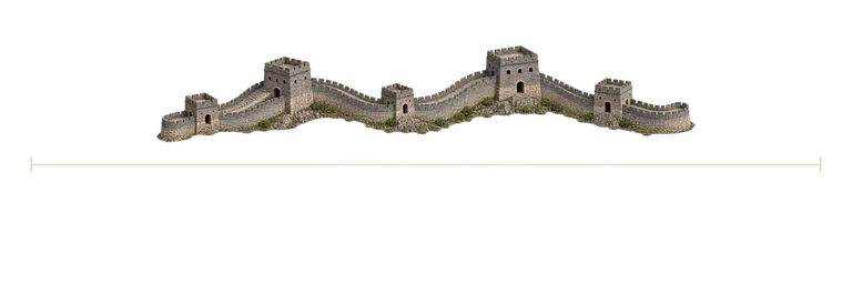
Great Wall of China, interpreted illustration
Interpreted illustration · dimension stated in the fact sheet.
How Big

What does this number measure?

The government source reports more than 21,000 km of combined sections. The rounded 21,000 km reference compares that sum, not a single intact continuous wall, a straight-line distance or an area. The illustration shows a representative section of Ming masonry; the separate ruler indicates the cumulative length. The drawing is not a complete map of the network.

Compare the stated dimensions

The comparison uses the number in each fact sheet: altitude, height, diameter, length or distance, depending on the reference. Two values in metres do not necessarily describe the same property.

Compare with Suez Canal in the explorer →

Source and limitations

Rounded reference: the source reports more than 21,000 km of sections from several periods. The illustrated section is representative and not at geographical scale; only the separate ruler carries the cumulative length.

The horizontal ruler compares approximately 21,000 km of combined sections. The section of wall is representative and not at geographical scale; its width and the height of its towers do not represent those 21,000 km. This is neither a single intact continuous wall nor a map of the complete network.

Illustration sources

How Big

Source coverage: Representative Ming section, not a map of the network; only the ruler carries the cumulative length.

Natural Earth (public domain)

Source coverage: Generalised main route, with coastlines and lakes from Natural Earth. Some current approaches, locks and parallel channels are not shown in detail. The map retains its geographical orientation; only the independent bar compares the documented length.

Natural Earth (public domain)

Source coverage: Generalised main route, with coastlines and lakes from Natural Earth. Some current approaches, locks and parallel channels are not shown in detail. The map retains its geographical orientation; only the independent bar compares the documented length.