
HOW BIG
DiscoverRivers

Rivers

Limpopo: size, dimension and comparison

The adopted reference is about 1,800 km.

river course length ≈ 1 800 km

1,800 km = 1,800,000 m. A kilometer contains 1,000 meters.

Africa · reference river course

Explore at this scale
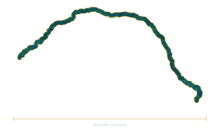
Limpopo, interpreted illustration
Interpreted illustration · dimension stated in the fact sheet.
Natural Earth (public domain)

What does this number measure?

Limpopo is presented in the Africa group. The comparison follows a reference course rather than a straight-line distance. The documented value is rounded; the choice of source, lakes crossed, meanders and river mouth can affect the published length.

This length follows the course adopted by the catalogue. Maps show simplified, sometimes partial courses; an independent bar represents the documented length, distinct from straight-line distance.

Compare the stated dimensions

The comparison uses the number in each fact sheet: altitude, height, diameter, length or distance, depending on the reference. Two values in metres do not necessarily describe the same property.

Compare with Chulym in the explorer →

Source and limitations

Approximate documentary length, dependent on the branches and route selected; this reference establishes neither a definite record nor kilometre-level precision.

Top view of a simplified geographic course of Limpopo, based on the available mapped segments. The reference drawing may be partial, and river systems may combine several branches. River width and the textures of water and banks are interpreted; this is not a satellite photograph. Only the lower bar represents the documented reference length; the width of the map above does not measure that length. Course data: Natural Earth, public domain. License: Public domain.

Illustration sources

Natural Earth (public domain)

Source coverage: Generalized map of the available published segments; it may be partial and include several branches. The documentary length is compared with the separate ruler, not with the width of the map. The complete course has not received individual hydrological certification. Natural Earth, public domain. Modified visualization: projection, generalized source trace, interpreted water/bank texture; 2026-11-04.

Natural Earth (public domain)

Source coverage: Generalized map of the available published segments; it may be partial and include several branches. The documentary length is compared with the separate ruler, not with the width of the map. The complete course has not received individual hydrological certification. Natural Earth, public domain. Modified visualization: projection, generalized source trace, interpreted water/bank texture; 2026-11-04.

Natural Earth (public domain)

Source coverage: Generalized map of the available published segments; it may be partial and include several branches. The documentary length is compared with the separate ruler, not with the width of the map. The complete course has not received individual hydrological certification. Natural Earth, public domain. Modified visualization: projection, generalized source trace, interpreted water/bank texture; 2026-11-04.

Natural Earth (public domain)

Source coverage: Generalized map of the available published segments; it may be partial and include several branches. The documentary length is compared with the separate ruler, not with the width of the map. The complete course has not received individual hydrological certification. Natural Earth, public domain. Modified visualization: projection, generalized source trace, interpreted water/bank texture; 2026-11-04.